Bogumiłowice geodata
Bogumiłowice (Lesser Poland) is a populated place; located in Poland in Europe/Warsaw (GMT+2) time zone. With population of 916 people, there are 2650 cities with bigger population in this country. Compared to other cities in Poland, 82.1% of cities are located further ↑North; 70.3% of cities are located further ←West and 56.8% of cities have lower elevation than Bogumiłowice. Note1
Administrative division(s):
- Level 1: Lesser Poland
- Level 2: Powiat tarnowski
- Level 3: Wierzchosławice


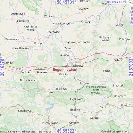
Bogumiłowice GPS coordinates[2]
50° 0' 26.064" North, 20° 52' 0.84" East
| Map corner | latitude | longitude |
|---|---|---|
| Upper-left | 50.45701°, | 20.16378° |
| Center: | 50.00724°, | 20.8669° |
| Lower-right: | 49.55322°, | 21.57003° |
| Map W x H: | 100.5×100.5 km | = 62.4×62.4mi |
| max Lat: | 54.83135° ⇑82.1% North |
| Bogumiłowice: | 50.00724° |
| min Lat: | ⇓17.9% South 49.21328° |
| min Long | Bogumiłowice | max Long |
| 14.20249° | 20.8669° | 24.03723° |
| W 70.3%⇐ | ⇒29.7% E |
Elevation
Elevation of Bogumiłowice is 190 m = 623 ft, and this is 1.4 m = 5 ft below average elevation for this country.
| Max E: |
974 m = 3196 ft | 43.2% |
| Avg. | 191.4 m = 628 ft | |
| Bogumiłowice | 190 m = 623 ft | |
Min E: |
-3 m = -10 ft | 56.8% |
See also: Poland elevation on elevation.city.
Geographical zone
Bogumiłowice is located in North temperate zone (between Tropic of Cancer and the Arctic Circle). Distance of this North polar circle is 1840.9 km =1143.9 mi to North.| Distance of | km | miles | from Bogumiłowice |
|---|---|---|---|
| North Pole | 4446.8 | 2763.1 | to North |
| Arctic Circle | 1840.9 | 1143.9 | to North |
| Tropic Cancer | 2954.4 | 1835.8 | to South |
| Equator | 5560.3 | 3455 | to South |


Nearby cities:
15 places around Bogumiłowice: (largest is in red/bold)
• Błonie
6.7 km =4.2 mi,  157°
157°
• Dębno
11.4 km =7.1 mi,  246°
246°
• Koszyce
6.6 km =4.1 mi,  126°
126°
• Koszyce Wielkie
6.3 km =3.9 mi,  117°
117°
• Niedomice
11.3 km =7 mi,  10°
10°
• Pleśna
10.6 km =6.6 mi,  148°
148°
• Radłów
8.6 km =5.3 mi,  351°
351°
• Rychwałd
12.3 km =7.6 mi, 155°
• Tarnowiec
9 km =5.6 mi,  108°
108°
• Tarnów
8.6 km =5.3 mi,  85°
85°
• Wielka Wieś
8.5 km =5.3 mi,  201°
201°
• Wierzchosławice
2.1 km =1.3 mi,  339°
339°
• Wojnicz
5.9 km =3.7 mi, 200°
• Wokowice
11.9 km =7.4 mi,  269°
269°
• Łukowa
12.3 km =7.6 mi,  39°
39°
Sources, notices
• [Note1] Compared only with cities in Poland existing in our database
• [Src1] Map data: © OpenStreetMap contributors (CC-BY-SA)
• [Src2] Other city data from geonames.org with taken over terms of usage.
• [Src3] Geographical zone / Annual Mean Temperature by Robert A. Rohde @ Wikipedia
