Baranowo geodata
Baranowo (Warmia-Masuria) is a populated place; located in Poland in Europe/Warsaw (GMT+2) time zone. With population of 600 people, there are 3270 cities with bigger population in this country. Compared to other cities in Poland, 92.4% of cities are located further ↓South; 78.6% of cities are located further ←West and 63.4% of cities have higher elevation than Baranowo. Note1


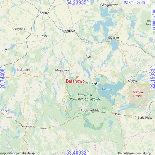
Baranowo GPS coordinates[2]
53° 49' 35.004" North, 21° 26' 49.92" East
| Map corner | latitude | longitude |
|---|---|---|
| Upper-left | 54.23935°, | 20.74408° |
| Center: | 53.82639°, | 21.4472° |
| Lower-right: | 53.40932°, | 22.15033° |
| Map W x H: | 92.3×92.3 km | = 57.4×57.4mi |
| max Lat: | 54.83135° ⇑7.6% North |
| Baranowo: | 53.82639° |
| min Lat: | ⇓92.4% South 49.21328° |
| min Long | Baranowo | max Long |
| 14.20249° | 21.4472° | 24.03723° |
| W 78.6%⇐ | ⇒21.4% E |
Elevation
Elevation of Baranowo is 138 m = 453 ft, and this is 53.4 m = 175 ft below average elevation for this country.
| Max E: |
974 m = 3196 ft | 63.4% |
| Avg. | 191.4 m = 628 ft | |
| Baranowo | 138 m = 453 ft | |
Min E: |
-3 m = -10 ft | 36.6% |
See also: Poland elevation on elevation.city.
Geographical zone
Baranowo is located in North temperate zone (between Tropic of Cancer and the Arctic Circle). Distance of this North polar circle is 1416.2 km =880 mi to North.| Distance of | km | miles | from Baranowo |
|---|---|---|---|
| North Pole | 4022.1 | 2499.2 | to North |
| Arctic Circle | 1416.2 | 880 | to North |
| Tropic Cancer | 3379 | 2099.6 | to South |
| Equator | 5984.9 | 3718.8 | to South |


Nearby cities:
15 places around Baranowo: (largest is in red/bold)
• Biskupiec
32.4 km =20.1 mi,  277°
277°
• Gierłoż
28.5 km =17.7 mi,  6°
6°
• Giżycko
31.4 km =19.5 mi,  41°
41°
• Kętrzyn
28.2 km =17.5 mi,  350°
350°
• Mikołajki
8.5 km =5.3 mi,  107°
107°
• Miłki
31.4 km =19.5 mi,  65°
65°
• Mrągowo
10.2 km =6.3 mi,  294°
294°
• Orzysz
32.9 km =20.4 mi,  93°
93°
• Piecki
10.4 km =6.5 mi,  222°
222°
• Pisz
32.7 km =20.3 mi,  132°
132°
• Reszel
31.8 km =19.8 mi,  321°
321°
• Ruciane-Nida
21.4 km =13.3 mi,  163°
163°
• Ryn
14 km =8.7 mi,  27°
27°
• Sorkwity
20.3 km =12.6 mi, 276°
• Świętajno
32.6 km =20.3 mi,  207°
207°
Sources, notices
• [Note1] Compared only with cities in Poland existing in our database
• [Src1] Map data: © OpenStreetMap contributors (CC-BY-SA)
• [Src2] Other city data from geonames.org with taken over terms of usage.
• [Src3] Geographical zone / Annual Mean Temperature by Robert A. Rohde @ Wikipedia
