Esperanza geodata
Esperanza (Vieques) is a populated place; located in Puerto Rico in America/Puerto_Rico (GMT-4) time zone. With population of 1,092 people, there are 212 cities with bigger population in this country. Compared to other cities in Puerto Rico, 67.6% of cities are located further ↑North; 99.1% of cities are located further ←West and 89.3% of cities have higher elevation than Esperanza. Note1


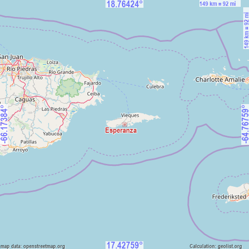
Esperanza GPS coordinates[2]
18° 5' 49.884" North, 65° 28' 14.556" West
| Map corner | latitude | longitude |
|---|---|---|
| Upper-left | 18.76424°, | -66.17384° |
| Center: | 18.09719°, | -65.47071° |
| Lower-right: | 17.42759°, | -64.76759° |
| Map W x H: | 148.6×148.6 km | = 92.3×92.3mi |
| max Lat: | 18.50078° ⇑67.6% North |
| Esperanza: | 18.09719° |
| min Lat: | ⇓32.4% South 17.95358° |
| min Long | Esperanza | max Long |
| -67.2499° | -65.47071° | -65.30099° |
| W 99.1%⇐ | ⇒0.90000000000001% E |
Elevation
Elevation of Esperanza is 8 m = 26 ft, and this is 92.5 m = 303 ft below average elevation for this country.
| Max E: |
655 m = 2149 ft | 89.3% |
| Avg. | 100.5 m = 330 ft | |
| Esperanza | 8 m = 26 ft | |
Min E: |
1 m = 3 ft | 10.7% |
See also: Puerto Rico elevation on elevation.city.
Geographical zone
Esperanza is located in North Torrid zone (between Equator and Tropic of Cancer). Distance of this Northern Tropic circle is 593.7 km =368.9 mi to North.| Distance of | km | miles | from Esperanza |
|---|---|---|---|
| North Pole | 7994.8 | 4967.7 | to North |
| Arctic Circle | 5389 | 3348.6 | to North |
| Tropic Cancer | 593.7 | 368.9 | to North |
| Equator | 2012.2 | 1250.3 | to South |


Nearby cities:
15 places around Esperanza: (largest is in red/bold)
• Aguas Claras
25.9 km =16.1 mi,  311°
311°
• Antón Ruiz
37 km =23 mi,  285°
285°
• Bajandas
33.5 km =20.8 mi,  281°
281°
• Ceiba
26.4 km =16.4 mi, 314°
• Culebra
29.1 km =18.1 mi,  38°
38°
• Daguao
26.7 km =16.6 mi,  302°
302°
• Duque
32.6 km =20.3 mi, 298°
• Fajardo
31.8 km =19.8 mi,  322°
322°
• Humacao
38.1 km =23.7 mi, 278°
• Isabel Segunda
6.5 km =4 mi,  27°
27°
• Luis M. Cintron
28.7 km =17.8 mi, 321°
• Naguabo
30.7 km =19.1 mi, 294°
• Punta Santiago
30.3 km =18.8 mi, 284°
• Ramos
37.1 km =23.1 mi, 316°
• Río Blanco
36.2 km =22.5 mi, 291°
Sources, notices
• [Note1] Compared only with cities in Puerto Rico existing in our database
• [Src1] Map data: © OpenStreetMap contributors (CC-BY-SA)
• [Src2] Other city data from geonames.org with taken over terms of usage.
• [Src3] Geographical zone / Annual Mean Temperature by Robert A. Rohde @ Wikipedia
