Isabel Segunda geodata
Isabel Segunda (Vieques) is a seat of a first-order administrative division; located in Puerto Rico in America/Puerto_Rico (GMT-4) time zone. With population of 9,301 people, there are 35 cities with bigger population in this country. Compared to other cities in Puerto Rico, 63.6% of cities are located further ↑North; 99.6% of cities are located further ←West and 77.8% of cities have higher elevation than Isabel Segunda. Note1


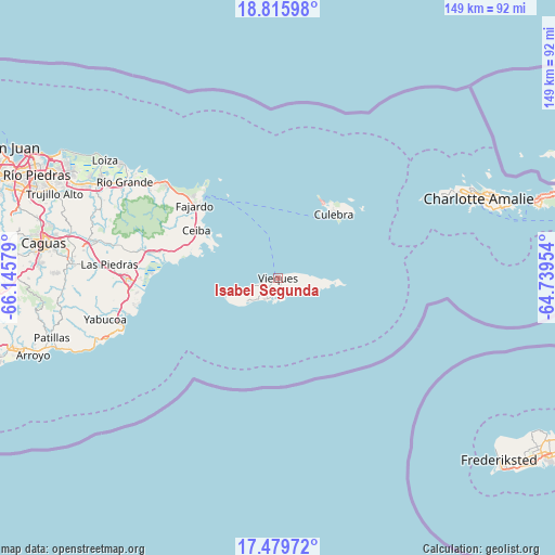
Isabel Segunda GPS coordinates[2]
18° 8' 56.868" North, 65° 26' 33.576" West
| Map corner | latitude | longitude |
|---|---|---|
| Upper-left | 18.81598°, | -66.14579° |
| Center: | 18.14913°, | -65.44266° |
| Lower-right: | 17.47972°, | -64.73954° |
| Map W x H: | 148.6×148.6 km | = 92.3×92.3mi |
| max Lat: | 18.50078° ⇑63.6% North |
| Isabel Segunda: | 18.14913° |
| min Lat: | ⇓36.4% South 17.95358° |
| min Long | Isabel Segunda | max Long |
| -67.2499° | -65.44266° | -65.30099° |
| W 99.6%⇐ | ⇒0.40000000000001% E |
Elevation
Elevation of Isabel Segunda is 16 m = 52 ft, and this is 84.5 m = 277 ft below average elevation for this country.
| Max E: |
655 m = 2149 ft | 77.8% |
| Avg. | 100.5 m = 330 ft | |
| Isabel Segunda | 16 m = 52 ft | |
Min E: |
1 m = 3 ft | 22.2% |
See also: Puerto Rico elevation on elevation.city.
Geographical zone
Isabel Segunda is located in North Torrid zone (between Equator and Tropic of Cancer). Distance of this Northern Tropic circle is 587.9 km =365.3 mi to North.| Distance of | km | miles | from Isabel Segunda |
|---|---|---|---|
| North Pole | 7989.1 | 4964.2 | to North |
| Arctic Circle | 5383.2 | 3345 | to North |
| Tropic Cancer | 587.9 | 365.3 | to North |
| Equator | 2018 | 1253.9 | to South |


Nearby cities:
15 places around Isabel Segunda: (largest is in red/bold)
• Aguas Claras
25.1 km =15.6 mi,  297°
297°
• Antón Ruiz
38.9 km =24.2 mi,  275°
275°
• Bajandas
35.8 km =22.2 mi,  271°
271°
• Ceiba
25.2 km =15.7 mi, 300°
• Culebra
22.7 km =14.1 mi,  41°
41°
• Daguao
26.8 km =16.7 mi,  288°
288°
• Duque
33.1 km =20.6 mi, 287°
• Esperanza
6.5 km =4 mi,  207°
207°
• Fajardo
29.6 km =18.4 mi,  311°
311°
• Luis M. Cintron
26.6 km =16.5 mi, 308°
• Luquillo
38.1 km =23.7 mi, 310°
• Naguabo
31.6 km =19.6 mi, 282°
• Punta Santiago
32.3 km =20.1 mi, 273°
• Ramos
35.5 km =22.1 mi, 306°
• Río Blanco
37.3 km =23.2 mi, 281°
Sources, notices
• [Note1] Compared only with cities in Puerto Rico existing in our database
• [Src1] Map data: © OpenStreetMap contributors (CC-BY-SA)
• [Src2] Other city data from geonames.org with taken over terms of usage.
• [Src3] Geographical zone / Annual Mean Temperature by Robert A. Rohde @ Wikipedia
