San Lázaro geodata
San Lázaro (Concepción) is a populated place; located in Paraguay in America/Asuncion (GMT-4) time zone. With population of 708 people, there are 151 cities with bigger population in this country. Compared to other cities in Paraguay, 98.1% of cities are located further ↓South; 95.7% of cities are located further →East and 87% of cities have higher elevation than San Lázaro. Note1


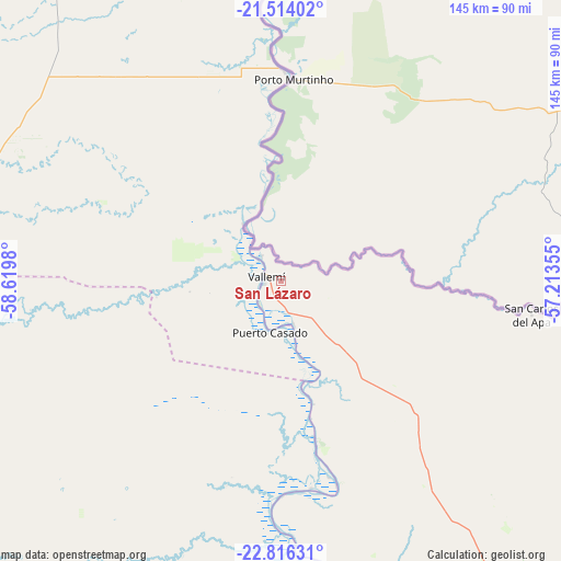
San Lázaro GPS coordinates[2]
22° 10' 0.012" South, 57° 55' 0.012" West
| Map corner | latitude | longitude |
|---|---|---|
| Upper-left | -21.51402°, | -58.6198° |
| Center: | -22.16667°, | -57.91667° |
| Lower-right: | -22.81631°, | -57.21355° |
| Map W x H: | 144.8×144.8 km | = 90×90mi |
| max Lat: | -19.91667° ⇑1.9% North |
| San Lázaro: | -22.16667° |
| min Lat: | ⇓98.1% South -27.38662° |
| min Long | San Lázaro | max Long |
| -60.78333° | -57.91667° | -54.30694° |
| W 4.3%⇐ | ⇒95.7% E |
Elevation
Elevation of San Lázaro is 86 m = 282 ft, and this is 83.7 m = 275 ft below average elevation for this country.
| Max E: |
658 m = 2159 ft | 87% |
| Avg. | 169.7 m = 557 ft | |
| San Lázaro | 86 m = 282 ft | |
Min E: |
46 m = 151 ft | 13% |
See also: Paraguay elevation on elevation.city.
Geographical zone
San Lázaro is located in South Torrid zone (between Equator and Tropic of Capricorn). Distance of this Southern Tropic circle is 141.2 km =87.7 mi to South.| Distance of | km | miles | from San Lázaro |
|---|---|---|---|
| Equator | 2464.7 | 1531.5 | to North |
| Tropic Capricorn | 141.2 | 87.7 | to South |
| Antarctic Circle | 4936.5 | 3067.4 | to South |
| South Pole | 7542.4 | 4686.6 | to South |


Nearby cities:
15 places around San Lázaro: (largest is in red/bold)
• Antequera
225.5 km =140.1 mi,  161°
161°
• Bella Vista
144.2 km =89.6 mi,  88°
88°
• Belén
159.3 km =99 mi, 155°
• Colonia Menno
196.8 km =122.3 mi,  263°
263°
• Colonia Neuland
232.9 km =144.7 mi, 256°
• Colonia Nueva Germania
230.4 km =143.2 mi,  147°
147°
• Concepción
145.8 km =90.6 mi, 160°
• Filadelfia
218.5 km =135.8 mi, 264°
• Fuerte Olimpo
125.2 km =77.8 mi,  2°
2°
• Horqueta
157.5 km =97.9 mi, 146°
• Pedro Juan Caballero
228.5 km =142 mi,  100°
100°
• San Carlos
64.4 km =40 mi, 99°
• San Pablo de Ycuámandyyú
237 km =147.3 mi, 158°
• San Pedro de Ycuamandiyú
229.6 km =142.7 mi, 158°
• Tacuatí
197.6 km =122.8 mi,  136°
136°
Sources, notices
• [Note1] Compared only with cities in Paraguay existing in our database
• [Src1] Map data: © OpenStreetMap contributors (CC-BY-SA)
• [Src2] Other city data from geonames.org with taken over terms of usage.
• [Src3] Geographical zone / Annual Mean Temperature by Robert A. Rohde @ Wikipedia
