Fuerte Olimpo geodata
Fuerte Olimpo (Alto Paraguay) is a seat of a first-order administrative division; located in Paraguay in America/Asuncion (GMT-4) time zone. With population of 2,475 people, there are 93 cities with bigger population in this country. Compared to other cities in Paraguay, 99.4% of cities are located further ↓South; 95.1% of cities are located further →East and 88.3% of cities have higher elevation than Fuerte Olimpo. Note1


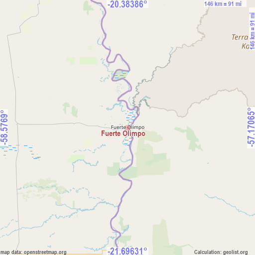
Fuerte Olimpo GPS coordinates[2]
21° 2' 29.508" South, 57° 52' 25.572" West
| Map corner | latitude | longitude |
|---|---|---|
| Upper-left | -20.38386°, | -58.5769° |
| Center: | -21.04153°, | -57.87377° |
| Lower-right: | -21.69631°, | -57.17065° |
| Map W x H: | 145.9×145.9 km | = 90.7×90.7mi |
| max Lat: | -19.91667° ⇑0.6% North |
| Fuerte Olimpo: | -21.04153° |
| min Lat: | ⇓99.4% South -27.38662° |
| min Long | Fuerte Olimpo | max Long |
| -60.78333° | -57.87377° | -54.30694° |
| W 4.9%⇐ | ⇒95.1% E |
Elevation
Elevation of Fuerte Olimpo is 84 m = 276 ft, and this is 85.7 m = 281 ft below average elevation for this country.
| Max E: |
658 m = 2159 ft | 88.3% |
| Avg. | 169.7 m = 557 ft | |
| Fuerte Olimpo | 84 m = 276 ft | |
Min E: |
46 m = 151 ft | 11.7% |
See also: Paraguay elevation on elevation.city.
Geographical zone
Fuerte Olimpo is located in South Torrid zone (between Equator and Tropic of Capricorn). Distance of this Southern Tropic circle is 266.3 km =165.5 mi to South.| Distance of | km | miles | from Fuerte Olimpo |
|---|---|---|---|
| Equator | 2339.6 | 1453.8 | to North |
| Tropic Capricorn | 266.3 | 165.5 | to South |
| Antarctic Circle | 5061.6 | 3145.1 | to South |
| South Pole | 7667.5 | 4764.4 | to South |


Nearby cities:
15 places around Fuerte Olimpo: (largest is in red/bold)
• Antequera
345.4 km =214.6 mi,  168°
168°
• Bella Vista
185.5 km =115.3 mi,  130°
130°
• Belén
276.8 km =172 mi, 166°
• Capitán Bado
345.4 km =214.6 mi,  135°
135°
• Capitán Pablo Lagerenza
327.9 km =203.7 mi,  292°
292°
• Colonia Menno
249 km =154.7 mi,  233°
233°
• Colonia Neuland
293.6 km =182.4 mi, 232°
• Colonia Nueva Germania
341.1 km =211.9 mi,  159°
159°
• Concepción
266.1 km =165.3 mi, 170°
• Filadelfia
265.6 km =165 mi,  237°
237°
• Horqueta
269.2 km =167.3 mi, 161°
• Pedro Juan Caballero
277.2 km =172.2 mi, 127°
• San Carlos
148.6 km =92.3 mi, 156°
• San Lázaro
125.2 km =77.8 mi,  182°
182°
• Tacuatí
298.9 km =185.7 mi,  153°
153°
Sources, notices
• [Note1] Compared only with cities in Paraguay existing in our database
• [Src1] Map data: © OpenStreetMap contributors (CC-BY-SA)
• [Src2] Other city data from geonames.org with taken over terms of usage.
• [Src3] Geographical zone / Annual Mean Temperature by Robert A. Rohde @ Wikipedia
