Bella Vista geodata
Bella Vista (Amambay) is a populated place; located in Paraguay in America/Asuncion (GMT-4) time zone. With population of 5,653 people, there are 53 cities with bigger population in this country. Compared to other cities in Paraguay, 98.8% of cities are located further ↓South; 54.9% of cities are located further ←West and 65.4% of cities have lower elevation than Bella Vista. Note1


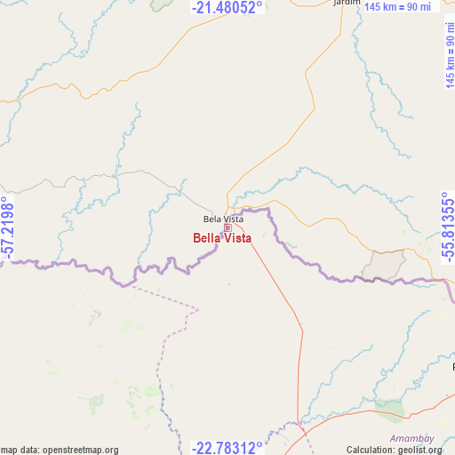
Bella Vista GPS coordinates[2]
22° 7' 59.988" South, 56° 31' 0.012" West
| Map corner | latitude | longitude |
|---|---|---|
| Upper-left | -21.48052°, | -57.2198° |
| Center: | -22.13333°, | -56.51667° |
| Lower-right: | -22.78312°, | -55.81355° |
| Map W x H: | 144.8×144.8 km | = 90×90mi |
| max Lat: | -19.91667° ⇑1.2% North |
| Bella Vista: | -22.13333° |
| min Lat: | ⇓98.8% South -27.38662° |
| min Long | Bella Vista | max Long |
| -60.78333° | -56.51667° | -54.30694° |
| W 54.9%⇐ | ⇒45.1% E |
Elevation
Elevation of Bella Vista is 173 m = 568 ft, and this is 3.3 m = 11 ft above average elevation for this country.
| Max E: |
658 m = 2159 ft | 34.6% |
| Bella Vista | 173 m 568 ft | |
| Avg. | 169.7 m = 557 ft | |
Min E: |
46 m = 151 ft | 65.4% |
See also: Paraguay elevation on elevation.city.
Geographical zone
Bella Vista is located in South Torrid zone (between Equator and Tropic of Capricorn). Distance of this Southern Tropic circle is 144.9 km =90 mi to South.| Distance of | km | miles | from Bella Vista |
|---|---|---|---|
| Equator | 2461 | 1529.2 | to North |
| Tropic Capricorn | 144.9 | 90 | to South |
| Antarctic Circle | 4940.2 | 3069.7 | to South |
| South Pole | 7546.1 | 4688.9 | to South |


Nearby cities:
15 places around Bella Vista: (largest is in red/bold)
• Antequera
228.1 km =141.7 mi,  197°
197°
• Belén
166.7 km =103.6 mi,  207°
207°
• Capitán Bado
161.4 km =100.3 mi,  141°
141°
• Chore
228.3 km =141.9 mi,  181°
181°
• Colonia Nueva Germania
198.6 km =123.4 mi,  185°
185°
• Concepción
169.2 km =105.1 mi, 213°
• Fuerte Olimpo
185.5 km =115.3 mi,  310°
310°
• Horqueta
145.6 km =90.5 mi, 202°
• Lima
194.6 km =120.9 mi, 178°
• Pedro Juan Caballero
92.8 km =57.7 mi,  119°
119°
• San Carlos
82 km =51 mi,  259°
259°
• San Lázaro
144.2 km =89.6 mi,  268°
268°
• San Pablo de Ycuámandyyú
231.2 km =143.7 mi, 194°
• San Pedro de Ycuamandiyú
224.8 km =139.7 mi, 195°
• Tacuatí
146.6 km =91.1 mi, 182°
Sources, notices
• [Note1] Compared only with cities in Paraguay existing in our database
• [Src1] Map data: © OpenStreetMap contributors (CC-BY-SA)
• [Src2] Other city data from geonames.org with taken over terms of usage.
• [Src3] Geographical zone / Annual Mean Temperature by Robert A. Rohde @ Wikipedia
