Zakamensk geodata
Zakamensk (Buryatiya Republic) is a populated place; located in Russia in Asia/Irkutsk (GMT+8) time zone. With population of 12,250 people, there are 1255 cities with bigger population in this country. Compared to other cities in Russia, 77% of cities are located further ↑North; 88.9% of cities are located further ←West and 98.8% of cities have lower elevation than Zakamensk. Note1


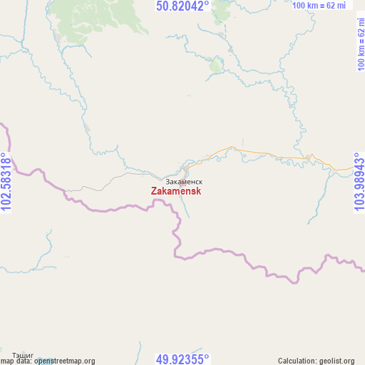
Zakamensk GPS coordinates[2]
50° 22' 26.76" North, 103° 17' 10.68" East
| Map corner | latitude | longitude |
|---|---|---|
| Upper-left | 50.82042°, | 102.58318° |
| Center: | 50.3741°, | 103.2863° |
| Lower-right: | 49.92355°, | 103.98943° |
| Map W x H: | 99.7×99.7 km | = 62×62mi |
| max Lat: | 73.50819° ⇑77% North |
| Zakamensk: | 50.3741° |
| min Lat: | ⇓23% South 41.28413° |
| min Long | Zakamensk | max Long |
| -179.12198° | 103.2863° | 179.35046° |
| W 88.9%⇐ | ⇒11.1% E |
Elevation
Elevation of Zakamensk is 1095 m = 3593 ft, and this is 892.4 m = 2928 ft above average elevation for this country.
| Max E: |
2518 m = 8261 ft | 1.2% |
| Zakamensk | 1095 m 3593 ft | |
| Avg. | 202.6 m = 665 ft | |
Min E: |
-28 m = -92 ft | 98.8% |
See also: Russia elevation on elevation.city.
Geographical zone
Zakamensk is located in North temperate zone (between Tropic of Cancer and the Arctic Circle). Distance of this North polar circle is 1800.1 km =1118.5 mi to North.| Distance of | km | miles | from Zakamensk |
|---|---|---|---|
| North Pole | 4406 | 2737.8 | to North |
| Arctic Circle | 1800.1 | 1118.5 | to North |
| Tropic Cancer | 2995.2 | 1861.1 | to South |
| Equator | 5601.1 | 3480.4 | to South |


Nearby cities:
15 places around Zakamensk: (largest is in red/bold)
• Bayangol
38.1 km =23.7 mi,  19°
19°
• Baykal’sk
140.3 km =87.2 mi,  25°
25°
• Kholtoson
8.6 km =5.3 mi,  168°
168°
• Kultuk
152.4 km =94.7 mi,  10°
10°
• Kyren
166.1 km =103.2 mi,  331°
331°
• Listvyanka
198.2 km =123.2 mi, 33°
• Moty
193.9 km =120.5 mi, 12°
• Petropavlovka
146.2 km =90.8 mi,  79°
79°
• Rechka-Vydrino
165.1 km =102.6 mi,  41°
41°
• Shamanka
191.8 km =119.2 mi, 11°
• Slyudyanka
145.9 km =90.7 mi, 11°
• Tankhoy
184.1 km =114.4 mi, 44°
• Utulik
141.1 km =87.7 mi, 22°
• Vydrino
153.9 km =95.6 mi, 38°
• Zhemchug
156.9 km =97.5 mi,  338°
338°
In other languages:
- In Spanish: Zakámensk
- In German: Sakamensk
- In Russian: Закаменск
- In Chinese: 扎卡缅斯克
Sources, notices
• [Note1] Compared only with cities in Russia existing in our database
• [Src1] Map data: © OpenStreetMap contributors (CC-BY-SA)
• [Src2] Other city data from geonames.org with taken over terms of usage.
• [Src3] Geographical zone / Annual Mean Temperature by Robert A. Rohde @ Wikipedia
