Petropavlovka geodata
Petropavlovka (Buryatiya Republic) is a populated place; located in Russia in Asia/Irkutsk (GMT+8) time zone. With population of 7,582 people, there are 1889 cities with bigger population in this country. Compared to other cities in Russia, 76.3% of cities are located further ↑North; 89.8% of cities are located further ←West and 95.9% of cities have lower elevation than Petropavlovka. Note1


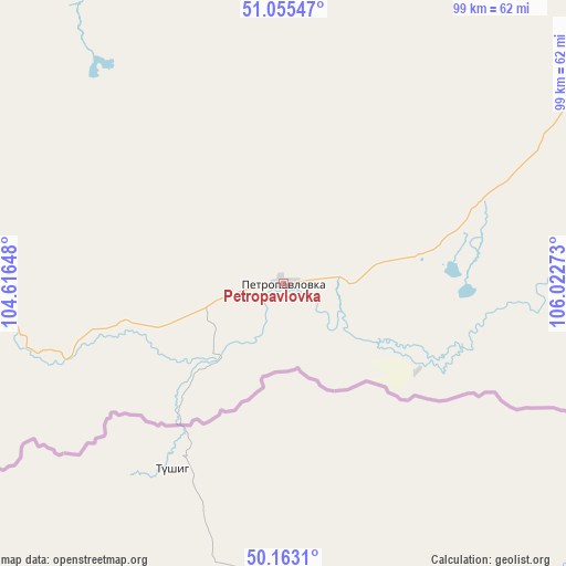
Petropavlovka GPS coordinates[2]
50° 36' 41.04" North, 105° 19' 10.56" East
| Map corner | latitude | longitude |
|---|---|---|
| Upper-left | 51.05547°, | 104.61648° |
| Center: | 50.6114°, | 105.3196° |
| Lower-right: | 50.1631°, | 106.02273° |
| Map W x H: | 99.2×99.2 km | = 61.6×61.6mi |
| max Lat: | 73.50819° ⇑76.3% North |
| Petropavlovka: | 50.6114° |
| min Lat: | ⇓23.7% South 41.28413° |
| min Long | Petropavlovka | max Long |
| -179.12198° | 105.3196° | 179.35046° |
| W 89.8%⇐ | ⇒10.2% E |
Elevation
Elevation of Petropavlovka is 687 m = 2254 ft, and this is 484.4 m = 1589 ft above average elevation for this country.
| Max E: |
2518 m = 8261 ft | 4.1% |
| Petropavlovka | 687 m 2254 ft | |
| Avg. | 202.6 m = 665 ft | |
Min E: |
-28 m = -92 ft | 95.9% |
See also: Russia elevation on elevation.city.
Geographical zone
Petropavlovka is located in North temperate zone (between Tropic of Cancer and the Arctic Circle). Distance of this North polar circle is 1773.7 km =1102.1 mi to North.| Distance of | km | miles | from Petropavlovka |
|---|---|---|---|
| North Pole | 4379.6 | 2721.4 | to North |
| Arctic Circle | 1773.7 | 1102.1 | to North |
| Tropic Cancer | 3021.5 | 1877.5 | to South |
| Equator | 5627.5 | 3496.8 | to South |


Nearby cities:
15 places around Petropavlovka: (largest is in red/bold)
• Babushkin
128.2 km =79.7 mi,  17°
17°
• Bayangol
131 km =81.4 mi,  274°
274°
• Baykal’sk
130 km =80.8 mi,  320°
320°
• Chikoy
119.5 km =74.3 mi,  108°
108°
• Dzhida
61.1 km =38 mi,  83°
83°
• Gusinoozyorsk
111.4 km =69.2 mi,  47°
47°
• Gusinoye Ozero
86.6 km =53.8 mi, 49°
• Kyakhta
84.8 km =52.7 mi, 109°
• Naushki
61.1 km =38 mi, 114°
• Okino-Klyuchi
126.3 km =78.5 mi,  90°
90°
• Rechka-Vydrino
103.1 km =64.1 mi,  341°
341°
• Selenduma
72.9 km =45.3 mi,  62°
62°
• Tankhoy
106 km =65.9 mi,  352°
352°
• Utulik
136.3 km =84.7 mi, 319°
• Vydrino
105.9 km =65.8 mi,  333°
333°
Sources, notices
• [Note1] Compared only with cities in Russia existing in our database
• [Src1] Map data: © OpenStreetMap contributors (CC-BY-SA)
• [Src2] Other city data from geonames.org with taken over terms of usage.
• [Src3] Geographical zone / Annual Mean Temperature by Robert A. Rohde @ Wikipedia
