Turka geodata
Turka (Buryatiya Republic) is a populated place; located in Russia in Asia/Irkutsk (GMT+8) time zone. With population of 1,472 people, there are 4402 cities with bigger population in this country. Compared to other cities in Russia, 63.1% of cities are located further ↑North; 90.8% of cities are located further ←West and 90.4% of cities have lower elevation than Turka. Note1


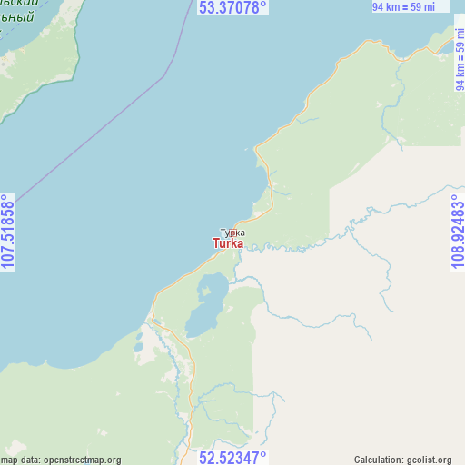
Turka GPS coordinates[2]
52° 56' 57.12" North, 108° 13' 18.12" East
| Map corner | latitude | longitude |
|---|---|---|
| Upper-left | 53.37078°, | 107.51858° |
| Center: | 52.9492°, | 108.2217° |
| Lower-right: | 52.52347°, | 108.92483° |
| Map W x H: | 94.2×94.2 km | = 58.5×58.5mi |
| max Lat: | 73.50819° ⇑63.1% North |
| Turka: | 52.9492° |
| min Lat: | ⇓36.9% South 41.28413° |
| min Long | Turka | max Long |
| -179.12198° | 108.2217° | 179.35046° |
| W 90.8%⇐ | ⇒9.2% E |
Elevation
Elevation of Turka is 461 m = 1512 ft, and this is 258.4 m = 848 ft above average elevation for this country.
| Max E: |
2518 m = 8261 ft | 9.6% |
| Turka | 461 m 1512 ft | |
| Avg. | 202.6 m = 665 ft | |
Min E: |
-28 m = -92 ft | 90.4% |
See also: Russia elevation on elevation.city.
Geographical zone
Turka is located in North temperate zone (between Tropic of Cancer and the Arctic Circle). Distance of this North polar circle is 1513.8 km =940.6 mi to North.| Distance of | km | miles | from Turka |
|---|---|---|---|
| North Pole | 4119.7 | 2559.9 | to North |
| Arctic Circle | 1513.8 | 940.6 | to North |
| Tropic Cancer | 3281.5 | 2039 | to South |
| Equator | 5887.4 | 3658.3 | to South |


Nearby cities:
15 places around Turka: (largest is in red/bold)
• Barguzin
120.1 km =74.6 mi,  51°
51°
• Il’inka
112.5 km =69.9 mi,  214°
214°
• Il’ka
138.1 km =85.8 mi,  171°
171°
• Khorinsk
136.5 km =84.8 mi,  129°
129°
• Khuzhir
64.9 km =40.3 mi,  294°
294°
• Novaya Bryan’
137 km =85.1 mi,  178°
178°
• Onokhoy
114 km =70.8 mi,  185°
185°
• Sotnikovo
128.6 km =79.9 mi,  202°
202°
• Tataurovo
104.2 km =64.7 mi, 210°
• Turuntayevo
91.8 km =57 mi, 205°
• Ulan-Ude
131.6 km =81.8 mi, 198°
• Ust’-Barguzin
74.5 km =46.3 mi, 46°
• Yelantsy
123 km =76.4 mi,  262°
262°
• Zaigrayevo
123.9 km =77 mi, 178°
• Zarechnyy
131.2 km =81.5 mi, 201°
Sources, notices
• [Note1] Compared only with cities in Russia existing in our database
• [Src1] Map data: © OpenStreetMap contributors (CC-BY-SA)
• [Src2] Other city data from geonames.org with taken over terms of usage.
• [Src3] Geographical zone / Annual Mean Temperature by Robert A. Rohde @ Wikipedia
