Loukhi geodata
Loukhi (Karelia) is a populated place; located in Russia in Europe/Moscow (GMT+3) time zone. With population of 5,764 people, there are 2342 cities with bigger population in this country. Compared to other cities in Russia, 98.1% of cities are located further ↓South; 92% of cities are located further →East and 72.6% of cities have higher elevation than Loukhi. Note1


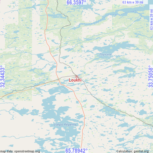
Loukhi GPS coordinates[2]
66° 4' 34.176" North, 33° 2' 50.82" East
| Map corner | latitude | longitude |
|---|---|---|
| Upper-left | 66.3597°, | 32.34433° |
| Center: | 66.07616°, | 33.04745° |
| Lower-right: | 65.78942°, | 33.75058° |
| Map W x H: | 63.4×63.4 km | = 39.4×39.4mi |
| max Lat: | 73.50819° ⇑1.9% North |
| Loukhi: | 66.07616° |
| min Lat: | ⇓98.1% South 41.28413° |
| min Long | Loukhi | max Long |
| -179.12198° | 33.04745° | 179.35046° |
| W 8%⇐ | ⇒92% E |
Elevation
Elevation of Loukhi is 95 m = 312 ft, and this is 107.6 m = 353 ft below average elevation for this country.
| Max E: |
2518 m = 8261 ft | 72.6% |
| Avg. | 202.6 m = 665 ft | |
| Loukhi | 95 m = 312 ft | |
Min E: |
-28 m = -92 ft | 27.4% |
See also: Russia elevation on elevation.city.
Geographical zone
Loukhi is located in North temperate zone (between Tropic of Cancer and the Arctic Circle). Distance of this North polar circle is 54.2 km =33.7 mi to North.| Distance of | km | miles | from Loukhi |
|---|---|---|---|
| North Pole | 2660.1 | 1652.9 | to North |
| Arctic Circle | 54.2 | 33.7 | to North |
| Tropic Cancer | 4741.1 | 2946 | to South |
| Equator | 7347 | 4565.2 | to South |


Nearby cities:
15 places around Loukhi: (largest is in red/bold)
• Afrikanda
152.4 km =94.7 mi,  355°
355°
• Ambarnyy
36.7 km =22.8 mi,  123°
123°
• Chupa
21.6 km =13.4 mi,  0°
0°
• Engozero
51.8 km =32.2 mi,  128°
128°
• Kalevala
129.5 km =80.5 mi,  221°
221°
• Kandalaksha
123.9 km =77 mi,  346°
346°
• Kem’
143.2 km =89 mi,  150°
150°
• Polyarnyye Zori
145.4 km =90.3 mi, 350°
• Poyakonda
58.5 km =36.4 mi, 350°
• Pyaozerskiy
95.2 km =59.2 mi,  248°
248°
• Rabocheostrovsk
144.8 km =90 mi, 146°
• Umba
89.1 km =55.4 mi,  40°
40°
• Yushkozero
153.6 km =95.4 mi,  196°
196°
• Zasheyek
149.3 km =92.8 mi, 351°
• Zelenoborskiy
90.7 km =56.4 mi,  340°
340°
Sources, notices
• [Note1] Compared only with cities in Russia existing in our database
• [Src1] Map data: © OpenStreetMap contributors (CC-BY-SA)
• [Src2] Other city data from geonames.org with taken over terms of usage.
• [Src3] Geographical zone / Annual Mean Temperature by Robert A. Rohde @ Wikipedia
