Solovetsky geodata
Solovetsky (Arkhangelskaya) is a populated place; located in Russia in Europe/Moscow (GMT+3) time zone. With population of 919 people, there are 4688 cities with bigger population in this country. Compared to other cities in Russia, 97.6% of cities are located further ↓South; 88% of cities are located further →East and 94.8% of cities have higher elevation than Solovetsky. Note1


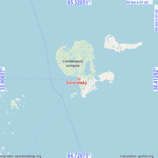
Solovetsky GPS coordinates[2]
65° 1' 31.008" North, 35° 42' 34.884" East
| Map corner | latitude | longitude |
|---|---|---|
| Upper-left | 65.32051°, | 35.00657° |
| Center: | 65.02528°, | 35.70969° |
| Lower-right: | 64.72675°, | 36.41282° |
| Map W x H: | 66×66 km | = 41×41mi |
| max Lat: | 73.50819° ⇑2.4% North |
| Solovetsky: | 65.02528° |
| min Lat: | ⇓97.6% South 41.28413° |
| min Long | Solovetsky | max Long |
| -179.12198° | 35.70969° | 179.35046° |
| W 12%⇐ | ⇒88% E |
Elevation
Elevation of Solovetsky is 13 m = 43 ft, and this is 189.6 m = 622 ft below average elevation for this country.
| Max E: |
2518 m = 8261 ft | 94.8% |
| Avg. | 202.6 m = 665 ft | |
| Solovetsky | 13 m = 43 ft | |
Min E: |
-28 m = -92 ft | 5.2% |
See also: Russia elevation on elevation.city.
Geographical zone
Solovetsky is located in North temperate zone (between Tropic of Cancer and the Arctic Circle). Distance of this North polar circle is 171 km =106.3 mi to North.| Distance of | km | miles | from Solovetsky |
|---|---|---|---|
| North Pole | 2776.9 | 1725.5 | to North |
| Arctic Circle | 171 | 106.3 | to North |
| Tropic Cancer | 4624.2 | 2873.3 | to South |
| Equator | 7230.1 | 4492.6 | to South |


Nearby cities:
15 places around Solovetsky: (largest is in red/bold)
• Ambarnyy
133.2 km =82.8 mi,  316°
316°
• Belomorsk
71.5 km =44.4 mi,  218°
218°
• Borovoy
170 km =105.6 mi,  254°
254°
• Chupa
184.3 km =114.5 mi, 318°
• Engozero
117.7 km =73.1 mi, 315°
• Kem’
53.7 km =33.4 mi,  261°
261°
• Ledmozero
195.1 km =121.2 mi,  243°
243°
• Loukhi
169.3 km =105.2 mi,  313°
313°
• Muyezerskiy
214.1 km =133 mi, 236°
• Nadvoitsy
145.1 km =90.2 mi,  207°
207°
• Onega
169.4 km =105.3 mi,  137°
137°
• Rabocheostrovsk
44.6 km =27.7 mi, 264°
• Segezha
157.6 km =97.9 mi, 205°
• Umba
194.9 km =121.1 mi,  341°
341°
• Yushkozero
172.9 km =107.4 mi, 259°
Sources, notices
• [Note1] Compared only with cities in Russia existing in our database
• [Src1] Map data: © OpenStreetMap contributors (CC-BY-SA)
• [Src2] Other city data from geonames.org with taken over terms of usage.
• [Src3] Geographical zone / Annual Mean Temperature by Robert A. Rohde @ Wikipedia
