Ambarnyy geodata
Ambarnyy (Karelia) is a populated place; located in Russia in Europe/Moscow (GMT+3) time zone. With population of 895 people, there are 4705 cities with bigger population in this country. Compared to other cities in Russia, 98% of cities are located further ↓South; 90.9% of cities are located further →East and 76.1% of cities have higher elevation than Ambarnyy. Note1


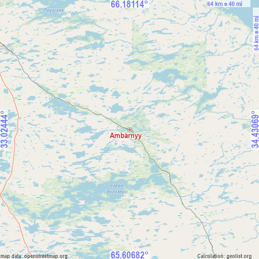
Ambarnyy GPS coordinates[2]
65° 53' 44.124" North, 33° 43' 39.216" East
| Map corner | latitude | longitude |
|---|---|---|
| Upper-left | 66.18114°, | 33.02444° |
| Center: | 65.89559°, | 33.72756° |
| Lower-right: | 65.60682°, | 34.43069° |
| Map W x H: | 63.9×63.9 km | = 39.7×39.7mi |
| max Lat: | 73.50819° ⇑2% North |
| Ambarnyy: | 65.89559° |
| min Lat: | ⇓98% South 41.28413° |
| min Long | Ambarnyy | max Long |
| -179.12198° | 33.72756° | 179.35046° |
| W 9.1%⇐ | ⇒90.9% E |
Elevation
Elevation of Ambarnyy is 84 m = 276 ft, and this is 118.6 m = 389 ft below average elevation for this country.
| Max E: |
2518 m = 8261 ft | 76.1% |
| Avg. | 202.6 m = 665 ft | |
| Ambarnyy | 84 m = 276 ft | |
Min E: |
-28 m = -92 ft | 23.9% |
See also: Russia elevation on elevation.city.
Geographical zone
Ambarnyy is located in North temperate zone (between Tropic of Cancer and the Arctic Circle). Distance of this North polar circle is 74.3 km =46.2 mi to North.| Distance of | km | miles | from Ambarnyy |
|---|---|---|---|
| North Pole | 2680.2 | 1665.4 | to North |
| Arctic Circle | 74.3 | 46.2 | to North |
| Tropic Cancer | 4721 | 2933.5 | to South |
| Equator | 7326.9 | 4552.7 | to South |


Nearby cities:
15 places around Ambarnyy: (largest is in red/bold)
• Belomorsk
160.1 km =99.5 mi,  162°
162°
• Borovoy
158.4 km =98.4 mi,  205°
205°
• Chupa
51.5 km =32 mi,  323°
323°
• Engozero
15.6 km =9.7 mi,  141°
141°
• Kalevala
140.1 km =87.1 mi,  236°
236°
• Kandalaksha
152.4 km =94.7 mi,  337°
337°
• Kem’
111.7 km =69.4 mi, 159°
• Loukhi
36.7 km =22.8 mi,  303°
303°
• Poyakonda
87.7 km =54.5 mi,  332°
332°
• Pyaozerskiy
120.9 km =75.1 mi,  263°
263°
• Rabocheostrovsk
112 km =69.6 mi,  154°
154°
• Solovetsky
133.2 km =82.8 mi, 136°
• Umba
92.2 km =57.3 mi,  17°
17°
• Yushkozero
147.9 km =91.9 mi, 210°
• Zelenoborskiy
121.8 km =75.7 mi, 330°
Sources, notices
• [Note1] Compared only with cities in Russia existing in our database
• [Src1] Map data: © OpenStreetMap contributors (CC-BY-SA)
• [Src2] Other city data from geonames.org with taken over terms of usage.
• [Src3] Geographical zone / Annual Mean Temperature by Robert A. Rohde @ Wikipedia
