Pankrushikha geodata
Pankrushikha (Altai Krai) is a populated place; located in Russia in Asia/Barnaul (GMT+7) time zone. With population of 5,160 people, there are 2572 cities with bigger population in this country. Compared to other cities in Russia, 56.5% of cities are located further ↑North; 79.5% of cities are located further ←West and 58.2% of cities have lower elevation than Pankrushikha. Note1


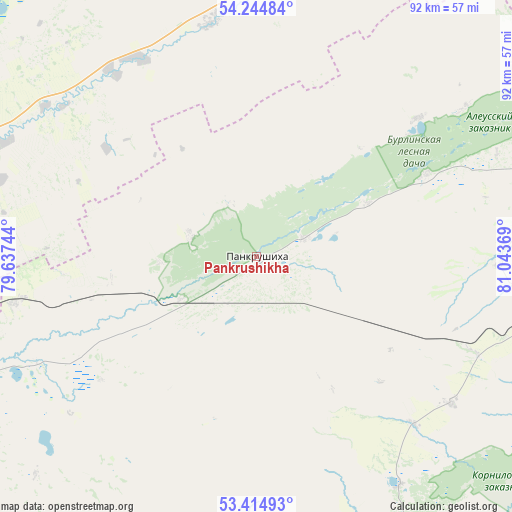
Pankrushikha GPS coordinates[2]
53° 49' 54.984" North, 80° 20' 26.016" East
| Map corner | latitude | longitude |
|---|---|---|
| Upper-left | 54.24484°, | 79.63744° |
| Center: | 53.83194°, | 80.34056° |
| Lower-right: | 53.41493°, | 81.04369° |
| Map W x H: | 92.3×92.3 km | = 57.4×57.4mi |
| max Lat: | 73.50819° ⇑56.5% North |
| Pankrushikha: | 53.83194° |
| min Lat: | ⇓43.5% South 41.28413° |
| min Long | Pankrushikha | max Long |
| -179.12198° | 80.34056° | 179.35046° |
| W 79.5%⇐ | ⇒20.5% E |
Elevation
Elevation of Pankrushikha is 164 m = 538 ft, and this is 38.6 m = 127 ft below average elevation for this country.
| Max E: |
2518 m = 8261 ft | 41.8% |
| Avg. | 202.6 m = 665 ft | |
| Pankrushikha | 164 m = 538 ft | |
Min E: |
-28 m = -92 ft | 58.2% |
See also: Russia elevation on elevation.city.
Geographical zone
Pankrushikha is located in North temperate zone (between Tropic of Cancer and the Arctic Circle). Distance of this North polar circle is 1415.6 km =879.6 mi to North.| Distance of | km | miles | from Pankrushikha |
|---|---|---|---|
| North Pole | 4021.5 | 2498.8 | to North |
| Arctic Circle | 1415.6 | 879.6 | to North |
| Tropic Cancer | 3379.6 | 2100 | to South |
| Equator | 5985.6 | 3719.3 | to South |


Nearby cities:
15 places around Pankrushikha: (largest is in red/bold)
• Bayevo
68.8 km =42.8 mi,  155°
155°
• Blagoveshchenka
115.4 km =71.7 mi,  195°
195°
• Gal’bshtadt
112.1 km =69.7 mi,  233°
233°
• Kamen’-na-Obi
65.9 km =40.9 mi,  94°
94°
• Khabary
57.8 km =35.9 mi,  246°
246°
• Kochki
56.8 km =35.3 mi,  9°
9°
• Krasnozërskoye
74.2 km =46.1 mi,  283°
283°
• Krutikha
58.7 km =36.5 mi,  75°
75°
• Kusak
115 km =71.5 mi, 233°
• Podsosnovo
106.9 km =66.4 mi,  241°
241°
• Polovinnoye
72.6 km =45.1 mi,  263°
263°
• Tyumentsevo
95.1 km =59.1 mi,  126°
126°
• Ust’yanka
113.5 km =70.5 mi, 248°
• Verkh-Suetka
61.8 km =38.4 mi, 198°
• Zav’yalovo
117 km =72.7 mi, 160°
Sources, notices
• [Note1] Compared only with cities in Russia existing in our database
• [Src1] Map data: © OpenStreetMap contributors (CC-BY-SA)
• [Src2] Other city data from geonames.org with taken over terms of usage.
• [Src3] Geographical zone / Annual Mean Temperature by Robert A. Rohde @ Wikipedia
