Eglise Catholique, Centrale GIKO geodata
Eglise Catholique, Centrale GIKO (Southern Province) is a populated locality; located in Rwanda in Africa/Kigali (GMT+2) time zone. With population of 3,000 people, there are 11 cities with bigger population in this country. Compared to other cities in Rwanda, 76.9% of cities are located further ↓South; 69.2% of cities are located further ←West and 53.8% of cities have higher elevation than Eglise Catholique, Centrale GIKO. Note1
Administrative division(s):
- Level 1: Southern Province
- Level 2: Kamonyi District
- Level 3: Kayumbu
- Level 4: Muyange
Current local time in Eglise Catholique, Centrale GIKO:
09:43 AM, MondayDifference from your time zone: hours


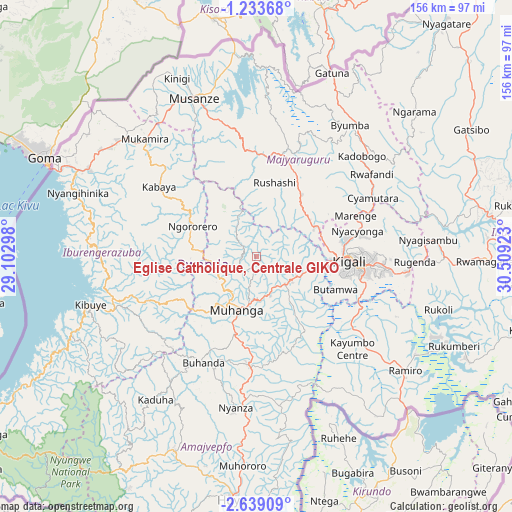
Eglise Catholique, Centrale GIKO GPS coordinates[2]
1° 56' 11.508" South, 29° 48' 21.96" East
| Map corner | latitude | longitude |
|---|---|---|
| Upper-left | -1.23368°, | 29.10298° |
| Center: | -1.93653°, | 29.8061° |
| Lower-right: | -2.63909°, | 30.50923° |
| Map W x H: | 156.3×156.3 km | = 97.1×97.1mi |
| max Lat: | -1.49984° ⇑23.1% North |
| Eglise Catholique, Centrale GIKO: | -1.93653° |
| min Lat: | ⇓76.9% South -2.59667° |
| min Long | Eglise Catholiq | max Long |
| 28.9075° | 29.8061° | 30.5427° |
| W 69.2%⇐ | ⇒30.8% E |
Elevation
Elevation of Eglise Catholique, Centrale GIKO is 1736 m = 5696 ft, and this is 0.90000000000009 m = 3 ft below average elevation for this country.
| Max E: |
2263 m = 7425 ft | 53.8% |
| Avg. | 1736.9 m = 5698 ft | |
| Eglise Catholique, Centrale GIKO | 1736 m = 5696 ft | |
Min E: |
1461 m = 4793 ft | 46.2% |
See also: Rwanda elevation on elevation.city.
Geographical zone
Eglise Catholique, Centrale GIKO is located in South Torrid zone (between Equator and Tropic of Capricorn). Distance of Equator is 215.3 km =133.8 mi to North.| Distance of | km | miles | from Eglise Catholique, Centrale GIKO |
|---|---|---|---|
| Equator | 215.3 | 133.8 | to North |
| Tropic Capricorn | 2390.6 | 1485.4 | to South |
| Antarctic Circle | 7185.9 | 4465.1 | to South |
| South Pole | 9791.7 | 6084.3 | to South |


Nearby cities:
13 places around Eglise Catholique, Centrale GIKO: (largest is in red/bold)
• Butare
73.8 km =45.9 mi,  185°
185°
• Byumba
49.5 km =30.8 mi,  35°
35°
• Cyangugu
117 km =72.7 mi,  238°
238°
• Gikongoro
64.1 km =39.8 mi,  203°
203°
• Gisenyi
66.4 km =41.3 mi,  293°
293°
• Gitarama
16.3 km =10.1 mi, 199°
• Kibungo
85.5 km =53.1 mi,  106°
106°
• Kibuye
52.8 km =32.8 mi,  254°
254°
• Kigali
28.1 km =17.5 mi,  93°
93°
• Musanze
52.1 km =32.4 mi,  338°
338°
• Nyanza
46.6 km =29 mi, 187°
• Nzega
66.4 km =41.3 mi, 204°
• Rwamagana
69.9 km =43.4 mi, 91°
Sources, notices
• [Note1] Compared only with cities in Rwanda existing in our database
• [Src1] Map data: © OpenStreetMap contributors (CC-BY-SA)
• [Src2] Other city data from geonames.org with taken over terms of usage.
• [Src3] Geographical zone / Annual Mean Temperature by Robert A. Rohde @ Wikipedia
