Wad az Zāki geodata
Wad az Zāki (White Nile) is a populated place; located in Sudan in Africa/Khartoum (GMT+2) time zone. With population of 9,271 people, there are 67 cities with bigger population in this country. Compared to other cities in Sudan, 63.4% of cities are located further ↓South; 57.7% of cities are located further →East and 70.4% of cities have higher elevation than Wad az Zāki. Note1


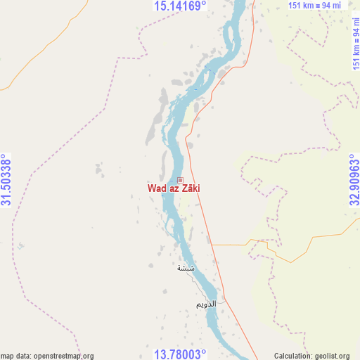
Wad az Zāki GPS coordinates[2]
14° 27' 42.84" North, 32° 12' 23.4" East
| Map corner | latitude | longitude |
|---|---|---|
| Upper-left | 15.14169°, | 31.50338° |
| Center: | 14.4619°, | 32.2065° |
| Lower-right: | 13.78003°, | 32.90963° |
| Map W x H: | 151.4×151.4 km | = 94.1×94.1mi |
| max Lat: | 21.06667° ⇑36.6% North |
| Wad az Zāki: | 14.4619° |
| min Lat: | ⇓63.4% South 10.55° |
| min Long | Wad az Zāki | max Long |
| 22.44725° | 32.2065° | 37.729° |
| W 42.3%⇐ | ⇒57.7% E |
Elevation
Elevation of Wad az Zāki is 390 m = 1280 ft, and this is 59.1 m = 194 ft below average elevation for this country.
| Max E: |
1159 m = 3802 ft | 70.4% |
| Avg. | 449.1 m = 1473 ft | |
| Wad az Zāki | 390 m = 1280 ft | |
Min E: |
4 m = 13 ft | 29.6% |
See also: Sudan elevation on elevation.city.
Geographical zone
Wad az Zāki is located in North Torrid zone (between Equator and Tropic of Cancer). Distance of this Northern Tropic circle is 997.9 km =620.1 mi to North.| Distance of | km | miles | from Wad az Zāki |
|---|---|---|---|
| North Pole | 8399 | 5218.9 | to North |
| Arctic Circle | 5793.2 | 3599.7 | to North |
| Tropic Cancer | 997.9 | 620.1 | to North |
| Equator | 1608 | 999.2 | to South |


Nearby cities:
15 places around Wad az Zāki: (largest is in red/bold)
• Ad Douiem
52.5 km =32.6 mi,  167°
167°
• Al Hasaheisa
121.8 km =75.7 mi,  74°
74°
• Al Hilāliyya
122.6 km =76.2 mi,  64°
64°
• Al Kawa
85.6 km =53.2 mi,  158°
158°
• Al Kiremit al ‘Arakiyyīn
80.4 km =50 mi,  99°
99°
• Al Manāqil
87.7 km =54.5 mi,  105°
105°
• Al Masallamiyya
122.4 km =76.1 mi,  84°
84°
• Al Qiţena
48 km =29.8 mi,  21°
21°
• Khartoum
126.1 km =78.4 mi, 16°
• Kināna
114.2 km =71 mi, 114°
• Kosti
152.6 km =94.8 mi, 161°
• Omdurman
134.7 km =83.7 mi,  12°
12°
• Um Jar Al Gharbiyya
76.6 km =47.6 mi, 163°
• Wad Medani
141.6 km =88 mi,  92°
92°
• Wad Rāwah
126.9 km =78.9 mi,  52°
52°
Sources, notices
• [Note1] Compared only with cities in Sudan existing in our database
• [Src1] Map data: © OpenStreetMap contributors (CC-BY-SA)
• [Src2] Other city data from geonames.org with taken over terms of usage.
• [Src3] Geographical zone / Annual Mean Temperature by Robert A. Rohde @ Wikipedia
