Al Qiţena geodata
Al Qiţena (White Nile) is a populated place; located in Sudan in Africa/Khartoum (GMT+2) time zone. With population of 18,321 people, there are 43 cities with bigger population in this country. Compared to other cities in Sudan, 67.6% of cities are located further ↓South; 54.9% of cities are located further →East and 73.2% of cities have higher elevation than Al Qiţena. Note1


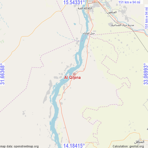
Al Qiţena GPS coordinates[2]
14° 51' 53.28" North, 32° 22' 0.48" East
| Map corner | latitude | longitude |
|---|---|---|
| Upper-left | 15.54331°, | 31.66368° |
| Center: | 14.8648°, | 32.3668° |
| Lower-right: | 14.18415°, | 33.06993° |
| Map W x H: | 151.1×151.1 km | = 93.9×93.9mi |
| max Lat: | 21.06667° ⇑32.4% North |
| Al Qiţena: | 14.8648° |
| min Lat: | ⇓67.6% South 10.55° |
| min Long | Al Qiţena | max Long |
| 22.44725° | 32.3668° | 37.729° |
| W 45.1%⇐ | ⇒54.9% E |
Elevation
Elevation of Al Qiţena is 387 m = 1270 ft, and this is 62.1 m = 204 ft below average elevation for this country.
| Max E: |
1159 m = 3802 ft | 73.2% |
| Avg. | 449.1 m = 1473 ft | |
| Al Qiţena | 387 m = 1270 ft | |
Min E: |
4 m = 13 ft | 26.8% |
See also: Sudan elevation on elevation.city.
Geographical zone
Al Qiţena is located in North Torrid zone (between Equator and Tropic of Cancer). Distance of this Northern Tropic circle is 953.1 km =592.2 mi to North.| Distance of | km | miles | from Al Qiţena |
|---|---|---|---|
| North Pole | 8354.3 | 5191.1 | to North |
| Arctic Circle | 5748.4 | 3571.9 | to North |
| Tropic Cancer | 953.1 | 592.2 | to North |
| Equator | 1652.8 | 1027 | to South |


Nearby cities:
15 places around Al Qiţena: (largest is in red/bold)
• Ad Douiem
96.2 km =59.8 mi,  183°
183°
• Al Hasaheisa
100.9 km =62.7 mi,  97°
97°
• Al Hilāliyya
93.6 km =58.2 mi,  84°
84°
• Al Kawa
125.2 km =77.8 mi,  173°
173°
• Al Kiremit al ‘Arakiyyīn
84.6 km =52.6 mi,  132°
132°
• Al Manāqil
96 km =59.7 mi,  135°
135°
• Al Masallamiyya
109.2 km =67.9 mi,  107°
107°
• Khartoum
78.4 km =48.7 mi,  13°
13°
• Kināna
126.5 km =78.6 mi, 136°
• Omdurman
87.5 km =54.4 mi, 7°
• Rabak
191.5 km =119 mi, 167°
• Um Jar Al Gharbiyya
118.3 km =73.5 mi, 177°
• Wad Medani
134.3 km =83.5 mi, 112°
• Wad Rāwah
89.3 km =55.5 mi,  68°
68°
• Wad az Zāki
48 km =29.8 mi,  201°
201°
Sources, notices
• [Note1] Compared only with cities in Sudan existing in our database
• [Src1] Map data: © OpenStreetMap contributors (CC-BY-SA)
• [Src2] Other city data from geonames.org with taken over terms of usage.
• [Src3] Geographical zone / Annual Mean Temperature by Robert A. Rohde @ Wikipedia
