Al Hasaheisa geodata
Al Hasaheisa (Al Jazīrah) is a populated place; located in Sudan in Africa/Khartoum (GMT+2) time zone. With population of 28,735 people, there are 28 cities with bigger population in this country. Compared to other cities in Sudan, 66.2% of cities are located further ↓South; 62% of cities are located further ←West and 63.4% of cities have higher elevation than Al Hasaheisa. Note1


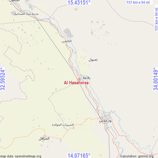
Al Hasaheisa GPS coordinates[2]
14° 45' 9.504" North, 33° 17' 54.096" East
| Map corner | latitude | longitude |
|---|---|---|
| Upper-left | 15.43151°, | 32.59524° |
| Center: | 14.75264°, | 33.29836° |
| Lower-right: | 14.07165°, | 34.00149° |
| Map W x H: | 151.2×151.2 km | = 94×94mi |
| max Lat: | 21.06667° ⇑33.8% North |
| Al Hasaheisa: | 14.75264° |
| min Lat: | ⇓66.2% South 10.55° |
| min Long | Al Hasaheisa | max Long |
| 22.44725° | 33.29836° | 37.729° |
| W 62%⇐ | ⇒38% E |
Elevation
Elevation of Al Hasaheisa is 401 m = 1316 ft, and this is 48.1 m = 158 ft below average elevation for this country.
| Max E: |
1159 m = 3802 ft | 63.4% |
| Avg. | 449.1 m = 1473 ft | |
| Al Hasaheisa | 401 m = 1316 ft | |
Min E: |
4 m = 13 ft | 36.6% |
See also: Sudan elevation on elevation.city.
Geographical zone
Al Hasaheisa is located in North Torrid zone (between Equator and Tropic of Cancer). Distance of this Northern Tropic circle is 965.6 km =600 mi to North.| Distance of | km | miles | from Al Hasaheisa |
|---|---|---|---|
| North Pole | 8366.7 | 5198.8 | to North |
| Arctic Circle | 5760.8 | 3579.6 | to North |
| Tropic Cancer | 965.6 | 600 | to North |
| Equator | 1640.3 | 1019.2 | to South |


Nearby cities:
15 places around Al Hasaheisa: (largest is in red/bold)
• Ad Douiem
135.2 km =84 mi,  231°
231°
• Al Hilāliyya
21.9 km =13.6 mi,  341°
341°
• Al Kawa
141.2 km =87.7 mi,  217°
217°
• Al Kiremit al ‘Arakiyyīn
59 km =36.7 mi, 220°
• Al Manāqil
65.4 km =40.6 mi,  210°
210°
• Al Masallamiyya
20.2 km =12.6 mi,  168°
168°
• Al Qiţena
100.9 km =62.7 mi,  277°
277°
• Khartoum
121 km =75.2 mi,  317°
317°
• Kināna
80.8 km =50.2 mi,  189°
189°
• Omdurman
132.6 km =82.4 mi, 318°
• Sinnar
134.8 km =83.8 mi, 167°
• Um Jar Al Gharbiyya
142.8 km =88.7 mi, 222°
• Wad Medani
45.8 km =28.5 mi,  148°
148°
• Wad Rāwah
48.4 km =30.1 mi, 339°
• Wad az Zāki
121.8 km =75.7 mi,  254°
254°
Sources, notices
• [Note1] Compared only with cities in Sudan existing in our database
• [Src1] Map data: © OpenStreetMap contributors (CC-BY-SA)
• [Src2] Other city data from geonames.org with taken over terms of usage.
• [Src3] Geographical zone / Annual Mean Temperature by Robert A. Rohde @ Wikipedia
