Singa geodata
Singa (Sinnār) is a seat of a first-order administrative division; located in Sudan in Africa/Khartoum (GMT+2) time zone. With population of 250,000 people, there are 11 cities with bigger population in this country. Compared to other cities in Sudan, 69% of cities are located further ↑North; 74.6% of cities are located further ←West and 56.3% of cities have lower elevation than Singa. Note1


Singa GPS coordinates[2]
13° 8' 53.88" North, 33° 55' 52.212" East
| Map corner | latitude | longitude |
|---|---|---|
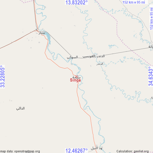
| Upper-left | 13.83202°, | 33.22805° |
| Center: | 13.1483°, | 33.93117° |
| Lower-right: | 12.46267°, | 34.6343° |
| Map W x H: | 152.3×152.3 km | = 94.6×94.6mi |
| max Lat: | 21.06667° ⇑69% North |
| Singa: | 13.1483° |
| min Lat: | ⇓31% South 10.55° |
| min Long | Singa | max Long |
| 22.44725° | 33.93117° | 37.729° |
| W 74.6%⇐ | ⇒25.4% E |
Elevation
Elevation of Singa is 441 m = 1447 ft, and this is 8.1 m = 27 ft below average elevation for this country.
| Max E: |
1159 m = 3802 ft | 43.7% |
| Avg. | 449.1 m = 1473 ft | |
| Singa | 441 m = 1447 ft | |
Min E: |
4 m = 13 ft | 56.3% |
See also: Singa elevation on elevation.city.
Geographical zone
Singa is located in North Torrid zone (between Equator and Tropic of Cancer). Distance of this Northern Tropic circle is 1144 km =710.8 mi to North.| Distance of | km | miles | from Singa |
|---|---|---|---|
| North Pole | 8545.1 | 5309.7 | to North |
| Arctic Circle | 5939.2 | 3690.4 | to North |
| Tropic Cancer | 1144 | 710.8 | to North |
| Equator | 1462 | 908.4 | to South |


Nearby cities:
15 places around Singa: (largest is in red/bold)
• Ad Dindar
26.1 km =16.2 mi,  77°
77°
• Ad-Damazin
158.1 km =98.2 mi,  162°
162°
• Al Kawa
168.5 km =104.7 mi,  293°
293°
• Al Kiremit al ‘Arakiyyīn
170.8 km =106.1 mi,  321°
321°
• Al Manāqil
158.9 km =98.7 mi, 320°
• Al Ḩawātah
81.6 km =50.7 mi,  68°
68°
• Ar Ruseris
150.9 km =93.8 mi, 160°
• As Sūkī
19.4 km =12.1 mi,  344°
344°
• Jalqani
83.8 km =52.1 mi, 158°
• Kināna
128.4 km =79.8 mi, 320°
• Kosti
137.3 km =85.3 mi,  270°
270°
• Maiurno
41.3 km =25.7 mi, 316°
• Rabak
129 km =80.2 mi, 271°
• Sinnar
61.2 km =38 mi, 319°
• Wad Medani
146.2 km =90.8 mi, 342°
Sources, notices
• [Note1] Compared only with cities in Sudan existing in our database
• [Src1] Map data: © OpenStreetMap contributors (CC-BY-SA)
• [Src2] Other city data from geonames.org with taken over terms of usage.
• [Src3] Geographical zone / Annual Mean Temperature by Robert A. Rohde @ Wikipedia
