Rabak geodata
Rabak (White Nile) is a seat of a first-order administrative division; located in Sudan in Africa/Khartoum (GMT+2) time zone. With population of 135,281 people, there are 14 cities with bigger population in this country. Compared to other cities in Sudan, 66.2% of cities are located further ↑North; 53.5% of cities are located further ←West and 64.8% of cities have higher elevation than Rabak. Note1


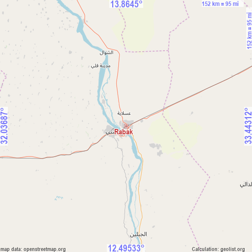
Rabak GPS coordinates[2]
13° 10' 51.132" North, 32° 44' 23.964" East
| Map corner | latitude | longitude |
|---|---|---|
| Upper-left | 13.8645°, | 32.03687° |
| Center: | 13.18087°, | 32.73999° |
| Lower-right: | 12.49533°, | 33.44312° |
| Map W x H: | 152.2×152.2 km | = 94.6×94.6mi |
| max Lat: | 21.06667° ⇑66.2% North |
| Rabak: | 13.18087° |
| min Lat: | ⇓33.8% South 10.55° |
| min Long | Rabak | max Long |
| 22.44725° | 32.73999° | 37.729° |
| W 53.5%⇐ | ⇒46.5% E |
Elevation
Elevation of Rabak is 399 m = 1309 ft, and this is 50.1 m = 164 ft below average elevation for this country.
| Max E: |
1159 m = 3802 ft | 64.8% |
| Avg. | 449.1 m = 1473 ft | |
| Rabak | 399 m = 1309 ft | |
Min E: |
4 m = 13 ft | 35.2% |
See also: Rabak elevation on elevation.city.
Geographical zone
Rabak is located in North Torrid zone (between Equator and Tropic of Cancer). Distance of this Northern Tropic circle is 1140.3 km =708.5 mi to North.| Distance of | km | miles | from Rabak |
|---|---|---|---|
| North Pole | 8541.5 | 5307.4 | to North |
| Arctic Circle | 5935.6 | 3688.2 | to North |
| Tropic Cancer | 1140.3 | 708.5 | to North |
| Equator | 1465.6 | 910.7 | to South |


Nearby cities:
15 places around Rabak: (largest is in red/bold)
• Ad Dindar
154.5 km =96 mi,  89°
89°
• Ad Douiem
102.3 km =63.6 mi,  333°
333°
• Al Kawa
68 km =42.3 mi,  337°
337°
• Al Kiremit al ‘Arakiyyīn
131.6 km =81.8 mi,  9°
9°
• Al Manāqil
121.4 km =75.4 mi, 12°
• As Sūkī
124.7 km =77.5 mi,  83°
83°
• Kināna
105.9 km =65.8 mi,  26°
26°
• Kosti
8.5 km =5.3 mi,  256°
256°
• Maiurno
103.6 km =64.4 mi, 75°
• Marabba
110.4 km =68.6 mi,  213°
213°
• Singa
129 km =80.2 mi, 91°
• Sinnar
99.3 km =61.7 mi,  64°
64°
• Tandaltī
96.3 km =59.8 mi, 259°
• Um Jar Al Gharbiyya
77.8 km =48.3 mi, 332°
• Wad az Zāki
153.6 km =95.4 mi, 337°
Sources, notices
• [Note1] Compared only with cities in Sudan existing in our database
• [Src1] Map data: © OpenStreetMap contributors (CC-BY-SA)
• [Src2] Other city data from geonames.org with taken over terms of usage.
• [Src3] Geographical zone / Annual Mean Temperature by Robert A. Rohde @ Wikipedia
