Tandaltī geodata
Tandaltī (White Nile) is a populated place; located in Sudan in Africa/Khartoum (GMT+2) time zone. With population of 27,275 people, there are 32 cities with bigger population in this country. Compared to other cities in Sudan, 70.4% of cities are located further ↑North; 60.6% of cities are located further →East and 53.5% of cities have higher elevation than Tandaltī. Note1


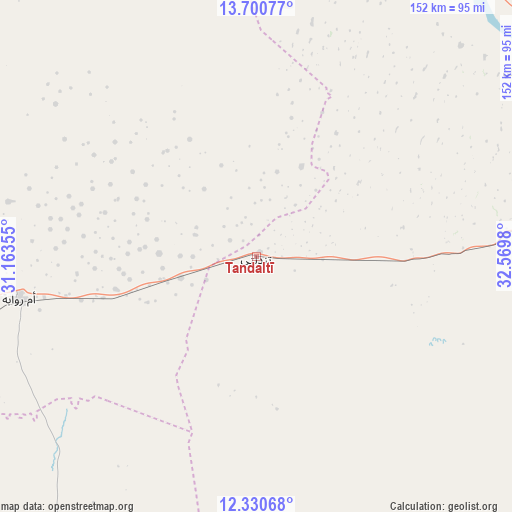
Tandaltī GPS coordinates[2]
13° 1' 0.012" North, 31° 52' 0.012" East
| Map corner | latitude | longitude |
|---|---|---|
| Upper-left | 13.70077°, | 31.16355° |
| Center: | 13.01667°, | 31.86667° |
| Lower-right: | 12.33068°, | 32.5698° |
| Map W x H: | 152.3×152.3 km | = 94.6×94.6mi |
| max Lat: | 21.06667° ⇑70.4% North |
| Tandaltī: | 13.01667° |
| min Lat: | ⇓29.6% South 10.55° |
| min Long | Tandaltī | max Long |
| 22.44725° | 31.86667° | 37.729° |
| W 39.4%⇐ | ⇒60.6% E |
Elevation
Elevation of Tandaltī is 422 m = 1385 ft, and this is 27.1 m = 89 ft below average elevation for this country.
| Max E: |
1159 m = 3802 ft | 53.5% |
| Avg. | 449.1 m = 1473 ft | |
| Tandaltī | 422 m = 1385 ft | |
Min E: |
4 m = 13 ft | 46.5% |
See also: Sudan elevation on elevation.city.
Geographical zone
Tandaltī is located in North Torrid zone (between Equator and Tropic of Cancer). Distance of this Northern Tropic circle is 1158.6 km =719.9 mi to North.| Distance of | km | miles | from Tandaltī |
|---|---|---|---|
| North Pole | 8559.7 | 5318.7 | to North |
| Arctic Circle | 5953.9 | 3699.6 | to North |
| Tropic Cancer | 1158.6 | 719.9 | to North |
| Equator | 1447.3 | 899.3 | to South |


Nearby cities:
15 places around Tandaltī: (largest is in red/bold)
• Abu Jibeha
186.9 km =116.1 mi,  201°
201°
• Ad Douiem
119.6 km =74.3 mi,  23°
23°
• Al Kawa
106.2 km =66 mi,  40°
40°
• Al Kiremit al ‘Arakiyyīn
188.2 km =116.9 mi, 38°
• Al Manāqil
182.7 km =113.5 mi, 41°
• Ar Rahad
136 km =84.5 mi,  255°
255°
• Bārah
179.2 km =111.3 mi,  295°
295°
• El Obeid
179.7 km =111.7 mi,  275°
275°
• Kināna
180.9 km =112.4 mi,  51°
51°
• Kosti
87.8 km =54.6 mi,  79°
79°
• Marabba
81.7 km =50.8 mi,  155°
155°
• Rabak
96.3 km =59.8 mi, 79°
• Um Jar Al Gharbiyya
105.1 km =65.3 mi,  33°
33°
• Umm Ruwaba
71.6 km =44.5 mi, 260°
• Wad az Zāki
164.8 km =102.4 mi,  12°
12°
Sources, notices
• [Note1] Compared only with cities in Sudan existing in our database
• [Src1] Map data: © OpenStreetMap contributors (CC-BY-SA)
• [Src2] Other city data from geonames.org with taken over terms of usage.
• [Src3] Geographical zone / Annual Mean Temperature by Robert A. Rohde @ Wikipedia
