Marabba geodata
Marabba (White Nile) is a populated place; located in Sudan in Africa/Khartoum (GMT+2) time zone. With population of 12,108 people, there are 51 cities with bigger population in this country. Compared to other cities in Sudan, 80.3% of cities are located further ↑North; 59.2% of cities are located further →East and 63.4% of cities have higher elevation than Marabba. Note1


Marabba GPS coordinates[2]
12° 21' 0" North, 32° 10' 59.988" East
| Map corner | latitude | longitude |
|---|---|---|
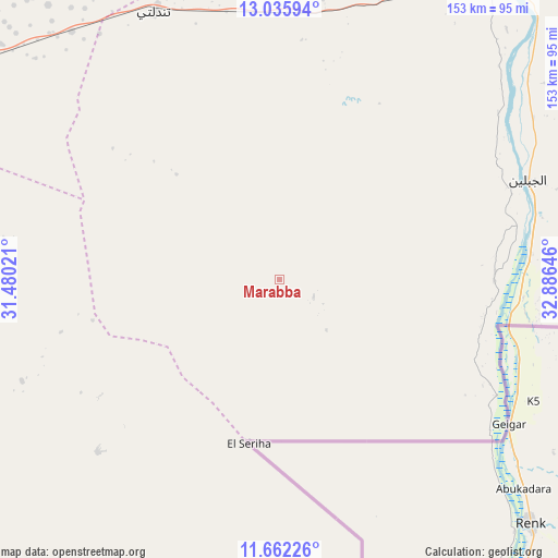
| Upper-left | 13.03594°, | 31.48021° |
| Center: | 12.35°, | 32.18333° |
| Lower-right: | 11.66226°, | 32.88646° |
| Map W x H: | 152.7×152.7 km | = 94.9×94.9mi |
| max Lat: | 21.06667° ⇑80.3% North |
| Marabba: | 12.35° |
| min Lat: | ⇓19.7% South 10.55° |
| min Long | Marabba | max Long |
| 22.44725° | 32.18333° | 37.729° |
| W 40.8%⇐ | ⇒59.2% E |
Elevation
Elevation of Marabba is 401 m = 1316 ft, and this is 48.1 m = 158 ft below average elevation for this country.
| Max E: |
1159 m = 3802 ft | 63.4% |
| Avg. | 449.1 m = 1473 ft | |
| Marabba | 401 m = 1316 ft | |
Min E: |
4 m = 13 ft | 36.6% |
See also: Sudan elevation on elevation.city.
Geographical zone
Marabba is located in North Torrid zone (between Equator and Tropic of Cancer). Distance of this Northern Tropic circle is 1232.7 km =766 mi to North.| Distance of | km | miles | from Marabba |
|---|---|---|---|
| North Pole | 8633.9 | 5364.9 | to North |
| Arctic Circle | 6028 | 3745.6 | to North |
| Tropic Cancer | 1232.7 | 766 | to North |
| Equator | 1373.2 | 853.3 | to South |


Nearby cities:
15 places around Marabba: (largest is in red/bold)
• Abu Jibeha
143.8 km =89.4 mi,  226°
226°
• Ad Douiem
184.1 km =114.4 mi,  4°
4°
• Al Kawa
159 km =98.8 mi,  12°
12°
• Ar Rahad
171.3 km =106.4 mi,  283°
283°
• As Sūkī
213.4 km =132.6 mi,  59°
59°
• Jalqani
221.3 km =137.5 mi,  87°
87°
• Kināna
215.8 km =134.1 mi,  29°
29°
• Kosti
104.3 km =64.8 mi, 29°
• Maiurno
199.8 km =124.1 mi,  53°
53°
• Rabak
110.4 km =68.6 mi, 33°
• Singa
209.3 km =130.1 mi, 64°
• Sinnar
202.1 km =125.6 mi, 47°
• Tandaltī
81.7 km =50.8 mi,  335°
335°
• Um Jar Al Gharbiyya
163.2 km =101.4 mi, 8°
• Umm Ruwaba
121.8 km =75.7 mi,  300°
300°
Sources, notices
• [Note1] Compared only with cities in Sudan existing in our database
• [Src1] Map data: © OpenStreetMap contributors (CC-BY-SA)
• [Src2] Other city data from geonames.org with taken over terms of usage.
• [Src3] Geographical zone / Annual Mean Temperature by Robert A. Rohde @ Wikipedia
