An Nuhūd geodata
An Nuhūd (West Kordofan State) is a populated place; located in Sudan in Africa/Khartoum (GMT+2) time zone. With population of 108,008 people, there are 18 cities with bigger population in this country. Compared to other cities in Sudan, 76.1% of cities are located further ↑North; 84.5% of cities are located further →East and 81.7% of cities have lower elevation than An Nuhūd. Note1


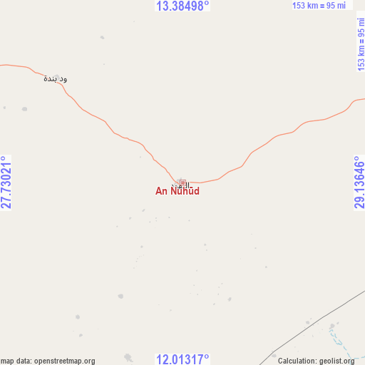
An Nuhūd GPS coordinates[2]
12° 42' 0" North, 28° 25' 59.988" East
| Map corner | latitude | longitude |
|---|---|---|
| Upper-left | 13.38498°, | 27.73021° |
| Center: | 12.7°, | 28.43333° |
| Lower-right: | 12.01317°, | 29.13646° |
| Map W x H: | 152.5×152.5 km | = 94.8×94.8mi |
| max Lat: | 21.06667° ⇑76.1% North |
| An Nuhūd: | 12.7° |
| min Lat: | ⇓23.9% South 10.55° |
| min Long | An Nuhūd | max Long |
| 22.44725° | 28.43333° | 37.729° |
| W 15.5%⇐ | ⇒84.5% E |
Elevation
Elevation of An Nuhūd is 571 m = 1873 ft, and this is 121.9 m = 400 ft above average elevation for this country.
| Max E: |
1159 m = 3802 ft | 18.3% |
| An Nuhūd | 571 m 1873 ft | |
| Avg. | 449.1 m = 1473 ft | |
Min E: |
4 m = 13 ft | 81.7% |
See also: An Nuhūd elevation on elevation.city.
Geographical zone
An Nuhūd is located in North Torrid zone (between Equator and Tropic of Cancer). Distance of this Northern Tropic circle is 1193.8 km =741.8 mi to North.| Distance of | km | miles | from An Nuhūd |
|---|---|---|---|
| North Pole | 8595 | 5340.7 | to North |
| Arctic Circle | 5989.1 | 3721.5 | to North |
| Tropic Cancer | 1193.8 | 741.8 | to North |
| Equator | 1412.1 | 877.4 | to South |


Nearby cities:
15 places around An Nuhūd: (largest is in red/bold)
• Abu Jibeha
333.9 km =207.5 mi,  114°
114°
• Abū Zabad
96.8 km =60.1 mi, 113°
• Al Fūlah
107.8 km =67 mi,  184°
184°
• Al Lagowa
163.4 km =101.5 mi,  152°
152°
• Al Mijlad
200.4 km =124.5 mi,  202°
202°
• Ar Rahad
240.4 km =149.4 mi,  89°
89°
• Bārah
237 km =147.3 mi,  62°
62°
• Dilling
150.6 km =93.6 mi,  118°
118°
• El Daein
286.2 km =177.8 mi,  241°
241°
• El Fula
110.3 km =68.5 mi, 184°
• El Obeid
200.6 km =124.6 mi,  74°
74°
• Kadugli
234.1 km =145.5 mi,  143°
143°
• Talodi
312.7 km =194.3 mi, 137°
• Umm Kaddadah
214 km =133 mi,  297°
297°
• Umm Ruwaba
302.6 km =188 mi, 85°
Sources, notices
• [Note1] Compared only with cities in Sudan existing in our database
• [Src1] Map data: © OpenStreetMap contributors (CC-BY-SA)
• [Src2] Other city data from geonames.org with taken over terms of usage.
• [Src3] Geographical zone / Annual Mean Temperature by Robert A. Rohde @ Wikipedia
