Al Fūlah geodata
Al Fūlah (Southern Kordofan) is a populated place; located in Sudan in Africa/Khartoum (GMT+2) time zone. With population of 11,238 people, there are 55 cities with bigger population in this country. Compared to other cities in Sudan, 87.3% of cities are located further ↑North; 85.9% of cities are located further →East and 77.5% of cities have lower elevation than Al Fūlah. Note1


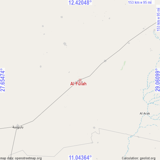
Al Fūlah GPS coordinates[2]
11° 43' 58.512" North, 28° 21' 28.296" East
| Map corner | latitude | longitude |
|---|---|---|
| Upper-left | 12.42048°, | 27.65474° |
| Center: | 11.73292°, | 28.35786° |
| Lower-right: | 11.04364°, | 29.06099° |
| Map W x H: | 153.1×153.1 km | = 95.1×95.1mi |
| max Lat: | 21.06667° ⇑87.3% North |
| Al Fūlah: | 11.73292° |
| min Lat: | ⇓12.7% South 10.55° |
| min Long | Al Fūlah | max Long |
| 22.44725° | 28.35786° | 37.729° |
| W 14.1%⇐ | ⇒85.9% E |
Elevation
Elevation of Al Fūlah is 519 m = 1703 ft, and this is 69.9 m = 229 ft above average elevation for this country.
| Max E: |
1159 m = 3802 ft | 22.5% |
| Al Fūlah | 519 m 1703 ft | |
| Avg. | 449.1 m = 1473 ft | |
Min E: |
4 m = 13 ft | 77.5% |
See also: Sudan elevation on elevation.city.
Geographical zone
Al Fūlah is located in North Torrid zone (between Equator and Tropic of Cancer). Distance of this Northern Tropic circle is 1301.3 km =808.6 mi to North.| Distance of | km | miles | from Al Fūlah |
|---|---|---|---|
| North Pole | 8702.5 | 5407.5 | to North |
| Arctic Circle | 6096.6 | 3788.3 | to North |
| Tropic Cancer | 1301.3 | 808.6 | to North |
| Equator | 1304.6 | 810.6 | to South |


Nearby cities:
15 places around Al Fūlah: (largest is in red/bold)
• Abu Jibeha
314.2 km =195.2 mi,  95°
95°
• Abū Zabad
118.8 km =73.8 mi,  54°
54°
• Al Lagowa
92.2 km =57.3 mi,  113°
113°
• Al Mijlad
103.4 km =64.2 mi,  221°
221°
• An Nuhūd
107.8 km =67 mi,  4°
4°
• Ar Rahad
272 km =169 mi,  66°
66°
• Bārah
308.7 km =191.8 mi,  44°
44°
• Dilling
144.9 km =90 mi,  75°
75°
• El Daein
245 km =152.2 mi,  262°
262°
• El Fula
2.7 km =1.7 mi,  208°
208°
• El Obeid
258.4 km =160.6 mi, 51°
• Kadugli
168.6 km =104.8 mi,  118°
118°
• Talodi
252.2 km =156.7 mi, 119°
• Umm Kaddadah
275.7 km =171.3 mi,  318°
318°
• Umm Ruwaba
336.7 km =209.2 mi, 67°
Sources, notices
• [Note1] Compared only with cities in Sudan existing in our database
• [Src1] Map data: © OpenStreetMap contributors (CC-BY-SA)
• [Src2] Other city data from geonames.org with taken over terms of usage.
• [Src3] Geographical zone / Annual Mean Temperature by Robert A. Rohde @ Wikipedia
