Stockaryd geodata
Stockaryd (Jönköping) is a populated place; located in Sweden in Europe/Stockholm (GMT+2) time zone. With population of 1,019 people, there are 803 cities with bigger population in this country. Compared to other cities in Sweden, 74.4% of cities are located further ↑North; 55.6% of cities are located further →East and 92.6% of cities have lower elevation than Stockaryd. Note1
Administrative division(s):
- Level 1: Jönköping
- Level 2: Sävsjö Kommun
- Level 3: Stockaryd
- Level 4: Stockaryd socken


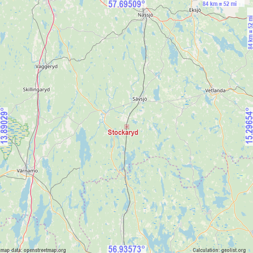
Stockaryd GPS coordinates[2]
57° 19' 2.532" North, 14° 35' 36.276" East
| Map corner | latitude | longitude |
|---|---|---|
| Upper-left | 57.69509°, | 13.89029° |
| Center: | 57.31737°, | 14.59341° |
| Lower-right: | 56.93573°, | 15.29654° |
| Map W x H: | 84.4×84.4 km | = 52.4×52.4mi |
| max Lat: | 67.85572° ⇑74.4% North |
| Stockaryd: | 57.31737° |
| min Lat: | ⇓25.6% South 55.34337° |
| min Long | Stockaryd | max Long |
| 11.1712° | 14.59341° | 24.13676° |
| W 44.4%⇐ | ⇒55.6% E |
Elevation
Elevation of Stockaryd is 226 m = 741 ft, and this is 143.4 m = 470 ft above average elevation for this country.
| Max E: |
663 m = 2175 ft | 7.4% |
| Stockaryd | 226 m 741 ft | |
| Avg. | 82.6 m = 271 ft | |
Min E: |
-1 m = -3 ft | 92.6% |
See also: Sweden elevation on elevation.city.
Geographical zone
Stockaryd is located in North temperate zone (between Tropic of Cancer and the Arctic Circle). Distance of this North polar circle is 1028.1 km =638.8 mi to North.| Distance of | km | miles | from Stockaryd |
|---|---|---|---|
| North Pole | 3634 | 2258.1 | to North |
| Arctic Circle | 1028.1 | 638.8 | to North |
| Tropic Cancer | 3767.2 | 2340.8 | to South |
| Equator | 6373.1 | 3960.1 | to South |


Nearby cities:
15 places around Stockaryd: (largest is in red/bold)
• Bodafors
21.3 km =13.2 mi,  17°
17°
• Burseryd
12.6 km =7.8 mi,  64°
64°
• Ekenässjön
32.2 km =20 mi,  52°
52°
• Hok
29 km =18 mi,  319°
319°
• Korsberga
32 km =19.9 mi,  92°
92°
• Lammhult
16.8 km =10.4 mi,  182°
182°
• Landsbro
19.2 km =11.9 mi,  73°
73°
• Linneryd
28.1 km =17.5 mi,  289°
289°
• Malmbäck
29.9 km =18.6 mi,  344°
344°
• Myresjö
23.4 km =14.5 mi, 71°
• Rörvik
8.9 km =5.5 mi,  186°
186°
• Skillingaryd
32.5 km =20.2 mi, 292°
• Sävsjö
10.4 km =6.5 mi, 23°
• Vetlanda
31.6 km =19.6 mi, 66°
• Vrigstad
8.4 km =5.2 mi,  295°
295°
Sources, notices
• [Note1] Compared only with cities in Sweden existing in our database
• [Src1] Map data: © OpenStreetMap contributors (CC-BY-SA)
• [Src2] Other city data from geonames.org with taken over terms of usage.
• [Src3] Geographical zone / Annual Mean Temperature by Robert A. Rohde @ Wikipedia
