Holsbybrunn geodata
Holsbybrunn (Jönköping) is a populated place; located in Sweden in Europe/Stockholm (GMT+2) time zone. With population of 783 people, there are 979 cities with bigger population in this country. Compared to other cities in Sweden, 72.5% of cities are located further ↑North; 52.1% of cities are located further ←West and 83.6% of cities have lower elevation than Holsbybrunn. Note1


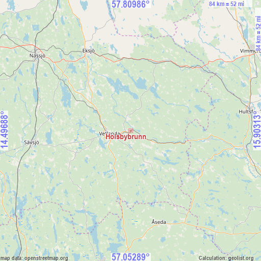
Holsbybrunn GPS coordinates[2]
57° 25' 59.988" North, 15° 12' 0" East
| Map corner | latitude | longitude |
|---|---|---|
| Upper-left | 57.80986°, | 14.49688° |
| Center: | 57.43333°, | 15.2° |
| Lower-right: | 57.05289°, | 15.90313° |
| Map W x H: | 84.2×84.2 km | = 52.3×52.3mi |
| max Lat: | 67.85572° ⇑72.5% North |
| Holsbybrunn: | 57.43333° |
| min Lat: | ⇓27.5% South 55.34337° |
| min Long | Holsbybrunn | max Long |
| 11.1712° | 15.2° | 24.13676° |
| W 52.1%⇐ | ⇒47.9% E |
Elevation
Elevation of Holsbybrunn is 162 m = 531 ft, and this is 79.4 m = 260 ft above average elevation for this country.
| Max E: |
663 m = 2175 ft | 16.4% |
| Holsbybrunn | 162 m 531 ft | |
| Avg. | 82.6 m = 271 ft | |
Min E: |
-1 m = -3 ft | 83.6% |
See also: Sweden elevation on elevation.city.
Geographical zone
Holsbybrunn is located in North temperate zone (between Tropic of Cancer and the Arctic Circle). Distance of this North polar circle is 1015.2 km =630.8 mi to North.| Distance of | km | miles | from Holsbybrunn |
|---|---|---|---|
| North Pole | 3621.1 | 2250 | to North |
| Arctic Circle | 1015.2 | 630.8 | to North |
| Tropic Cancer | 3780.1 | 2348.8 | to South |
| Equator | 6386 | 3968.1 | to South |


Nearby cities:
15 places around Holsbybrunn: (largest is in red/bold)
• Bodafors
30.8 km =19.1 mi,  283°
283°
• Burseryd
26 km =16.2 mi,  253°
253°
• Ekenässjön
12.5 km =7.8 mi,  301°
301°
• Eksjö
29.3 km =18.2 mi,  332°
332°
• Hällaryd
4.2 km =2.6 mi, 331°
• Järnforsen
25 km =15.5 mi,  94°
94°
• Korsberga
15.2 km =9.4 mi,  197°
197°
• Landsbro
19.4 km =12.1 mi, 247°
• Mariannelund
29.9 km =18.6 mi,  47°
47°
• Myresjö
15.2 km =9.4 mi, 249°
• Skruv
31.6 km =19.6 mi,  183°
183°
• Sävsjö
32.4 km =20.1 mi,  264°
264°
• Vetlanda
7.3 km =4.5 mi,  266°
266°
• Virserum
26.4 km =16.4 mi,  119°
119°
• Åseda
30.5 km =19 mi,  163°
163°
Sources, notices
• [Note1] Compared only with cities in Sweden existing in our database
• [Src1] Map data: © OpenStreetMap contributors (CC-BY-SA)
• [Src2] Other city data from geonames.org with taken over terms of usage.
• [Src3] Geographical zone / Annual Mean Temperature by Robert A. Rohde @ Wikipedia
