Hällaryd geodata
Hällaryd (Jönköping) is a populated place; located in Sweden in Europe/Stockholm (GMT+2) time zone. With population of 553 people, there are 1228 cities with bigger population in this country. Compared to other cities in Sweden, 72.3% of cities are located further ↑North; 51.8% of cities are located further ←West and 83.8% of cities have lower elevation than Hällaryd. Note1


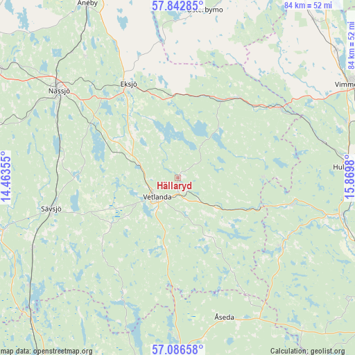
Hällaryd GPS coordinates[2]
57° 28' 0.012" North, 15° 10' 0.012" East
| Map corner | latitude | longitude |
|---|---|---|
| Upper-left | 57.84285°, | 14.46355° |
| Center: | 57.46667°, | 15.16667° |
| Lower-right: | 57.08658°, | 15.8698° |
| Map W x H: | 84.1×84.1 km | = 52.3×52.3mi |
| max Lat: | 67.85572° ⇑72.3% North |
| Hällaryd: | 57.46667° |
| min Lat: | ⇓27.7% South 55.34337° |
| min Long | Hällaryd | max Long |
| 11.1712° | 15.16667° | 24.13676° |
| W 51.8%⇐ | ⇒48.2% E |
Elevation
Elevation of Hällaryd is 163 m = 535 ft, and this is 80.4 m = 264 ft above average elevation for this country.
| Max E: |
663 m = 2175 ft | 16.2% |
| Hällaryd | 163 m 535 ft | |
| Avg. | 82.6 m = 271 ft | |
Min E: |
-1 m = -3 ft | 83.8% |
See also: Sweden elevation on elevation.city.
Geographical zone
Hällaryd is located in North temperate zone (between Tropic of Cancer and the Arctic Circle). Distance of this North polar circle is 1011.5 km =628.5 mi to North.| Distance of | km | miles | from Hällaryd |
|---|---|---|---|
| North Pole | 3617.4 | 2247.7 | to North |
| Arctic Circle | 1011.5 | 628.5 | to North |
| Tropic Cancer | 3783.8 | 2351.1 | to South |
| Equator | 6389.7 | 3970.4 | to South |


Nearby cities:
15 places around Hällaryd: (largest is in red/bold)
• Bodafors
28.1 km =17.5 mi,  277°
277°
• Burseryd
25.5 km =15.8 mi,  244°
244°
• Ekenässjön
9.1 km =5.7 mi,  287°
287°
• Eksjö
25.1 km =15.6 mi,  332°
332°
• Holsbybrunn
4.2 km =2.6 mi,  151°
151°
• Järnforsen
27.5 km =17.1 mi,  101°
101°
• Korsberga
18.4 km =11.4 mi,  187°
187°
• Landsbro
19.5 km =12.1 mi, 235°
• Mariannelund
29.1 km =18.1 mi,  55°
55°
• Myresjö
15.2 km =9.4 mi,  233°
233°
• Nässjö
34.9 km =21.7 mi,  306°
306°
• Sävsjö
31 km =19.3 mi,  256°
256°
• Vetlanda
6.8 km =4.2 mi, 231°
• Virserum
30 km =18.6 mi,  123°
123°
• Åseda
34.7 km =21.6 mi,  162°
162°
Sources, notices
• [Note1] Compared only with cities in Sweden existing in our database
• [Src1] Map data: © OpenStreetMap contributors (CC-BY-SA)
• [Src2] Other city data from geonames.org with taken over terms of usage.
• [Src3] Geographical zone / Annual Mean Temperature by Robert A. Rohde @ Wikipedia
