Prestranek geodata
Prestranek (Postojna) is a populated place; located in Slovenia in Europe/Ljubljana (GMT+2) time zone. With population of 708 people, there are 352 cities with bigger population in this country. Compared to other cities in Slovenia, 90.2% of cities are located further ↑North; 81.7% of cities are located further →East and 90% of cities have lower elevation than Prestranek. Note1


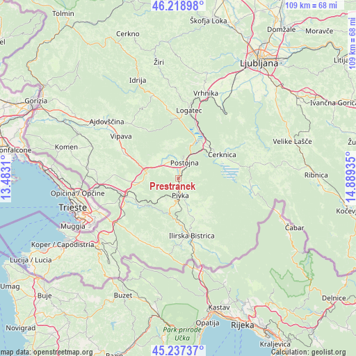
Prestranek GPS coordinates[2]
45° 43' 49.188" North, 14° 11' 10.392" East
| Map corner | latitude | longitude |
|---|---|---|
| Upper-left | 46.21898°, | 13.4831° |
| Center: | 45.73033°, | 14.18622° |
| Lower-right: | 45.23737°, | 14.88935° |
| Map W x H: | 109.1×109.1 km | = 67.8×67.8mi |
| max Lat: | 46.83694° ⇑90.2% North |
| Prestranek: | 45.73033° |
| min Lat: | ⇓9.8% South 45.47667° |
| min Long | Prestranek | max Long |
| 13.52639° | 14.18622° | 16.4975° |
| W 18.3%⇐ | ⇒81.7% E |
Elevation
Elevation of Prestranek is 531 m = 1742 ft, and this is 205.4 m = 674 ft above average elevation for this country.
| Max E: |
1551 m = 5089 ft | 10% |
| Prestranek | 531 m 1742 ft | |
| Avg. | 325.6 m = 1068 ft | |
Min E: |
2 m = 7 ft | 90% |
See also: Slovenia elevation on elevation.city.
Geographical zone
Prestranek is located in North temperate zone (between Tropic of Cancer and the Arctic Circle). Distance of this North polar circle is 2316.4 km =1439.3 mi to North.| Distance of | km | miles | from Prestranek |
|---|---|---|---|
| North Pole | 4922.3 | 3058.6 | to North |
| Arctic Circle | 2316.4 | 1439.3 | to North |
| Tropic Cancer | 2478.8 | 1540.3 | to South |
| Equator | 5084.7 | 3159.5 | to South |


Nearby cities:
15 places around Prestranek: (largest is in red/bold)
• Begunje pri Cerknici
18.1 km =11.2 mi,  57°
57°
• Cerknica
15.4 km =9.6 mi, 62°
• Divača
17.5 km =10.9 mi,  253°
253°
• Dolnji Zemon
21.2 km =13.2 mi,  162°
162°
• Ilirska Bistrica
18.7 km =11.6 mi,  165°
165°
• Kalce
18.4 km =11.4 mi,  1°
1°
• Logatec
20.7 km =12.9 mi,  8°
8°
• Lokev
21.5 km =13.4 mi, 248°
• Pivka
5.3 km =3.3 mi, 171°
• Planina
12 km =7.5 mi,  24°
24°
• Postojna
5.4 km =3.4 mi, 24°
• Rakek
13.4 km =8.3 mi,  46°
46°
• Senožeče
11.3 km =7 mi,  264°
264°
• Unec
12.6 km =7.8 mi,  41°
41°
• Vipava
21.6 km =13.4 mi,  306°
306°
Sources, notices
• [Note1] Compared only with cities in Slovenia existing in our database
• [Src1] Map data: © OpenStreetMap contributors (CC-BY-SA)
• [Src2] Other city data from geonames.org with taken over terms of usage.
• [Src3] Geographical zone / Annual Mean Temperature by Robert A. Rohde @ Wikipedia
