Zimmi geodata
Zimmi (Southern Province) is a populated place; located in Sierra Leone in Africa/Freetown (GMT+0) time zone. With population of 4,796 people, there are 48 cities with bigger population in this country. Compared to other cities in Sierra Leone, 98.8% of cities are located further ↑North; 67.5% of cities are located further ←West and 55.4% of cities have higher elevation than Zimmi. Note1


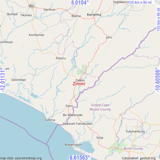
Zimmi GPS coordinates[2]
7° 18' 48.816" North, 11° 18' 29.448" West
| Map corner | latitude | longitude |
|---|---|---|
| Upper-left | 8.0104°, | -12.01131° |
| Center: | 7.31356°, | -11.30818° |
| Lower-right: | 6.61563°, | -10.60506° |
| Map W x H: | 155.1×155.1 km | = 96.4×96.4mi |
| max Lat: | 9.91376° ⇑98.8% North |
| Zimmi: | 7.31356° |
| min Lat: | ⇓1.2% South 7.24611° |
| min Long | Zimmi | max Long |
| -13.28972° | -11.30818° | -10.37135° |
| W 67.5%⇐ | ⇒32.5% E |
Elevation
Elevation of Zimmi is 90 m = 295 ft, and this is 67.2 m = 220 ft below average elevation for this country.
| Max E: |
564 m = 1850 ft | 55.4% |
| Avg. | 157.2 m = 516 ft | |
| Zimmi | 90 m = 295 ft | |
Min E: |
1 m = 3 ft | 44.6% |
See also: Sierra Leone elevation on elevation.city.
Geographical zone
Zimmi is located in North Torrid zone (between Equator and Tropic of Cancer). Distance of Equator is 813.2 km =505.3 mi to South.| Distance of | km | miles | from Zimmi |
|---|---|---|---|
| North Pole | 9193.9 | 5712.8 | to North |
| Arctic Circle | 6588 | 4093.6 | to North |
| Tropic Cancer | 1792.7 | 1113.9 | to North |
| Equator | 813.2 | 505.3 | to South |


Nearby cities:
15 places around Zimmi: (largest is in red/bold)
• Blama
62.5 km =38.8 mi,  356°
356°
• Bomi
25.1 km =15.6 mi,  252°
252°
• Foindu
28 km =17.4 mi,  292°
292°
• Gandorhun
50.2 km =31.2 mi,  302°
302°
• Gandorhun
61 km =37.9 mi, 289°
• Gbewebu
42.3 km =26.3 mi,  308°
308°
• Giehun
69.6 km =43.2 mi,  24°
24°
• Gorahun
18.4 km =11.4 mi, 24°
• Hangha
72 km =44.7 mi,  14°
14°
• Kenema
64 km =39.8 mi, 11°
• Koribundu
61.2 km =38 mi,  316°
316°
• Potoru
28.5 km =17.7 mi, 318°
• Pujehun
45.8 km =28.5 mi,  276°
276°
• Sumbuya
81 km =50.3 mi, 297°
• Tongole
67.1 km =41.7 mi, 283°
Sources, notices
• [Note1] Compared only with cities in Sierra Leone existing in our database
• [Src1] Map data: © OpenStreetMap contributors (CC-BY-SA)
• [Src2] Other city data from geonames.org with taken over terms of usage.
• [Src3] Geographical zone / Annual Mean Temperature by Robert A. Rohde @ Wikipedia
