Gbewebu geodata
Gbewebu (Southern Province) is a populated place; located in Sierra Leone in Africa/Freetown (GMT+0) time zone. With population of 4,122 people, there are 53 cities with bigger population in this country. Compared to other cities in Sierra Leone, 89.2% of cities are located further ↑North; 54.2% of cities are located further ←West and 61.4% of cities have higher elevation than Gbewebu. Note1


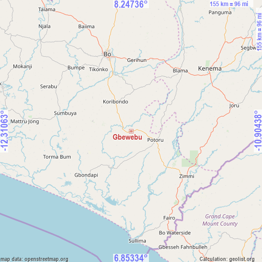
Gbewebu GPS coordinates[2]
7° 33' 3.276" North, 11° 36' 27" West
| Map corner | latitude | longitude |
|---|---|---|
| Upper-left | 8.24736°, | -12.31063° |
| Center: | 7.55091°, | -11.6075° |
| Lower-right: | 6.85334°, | -10.90438° |
| Map W x H: | 155×155 km | = 96.3×96.3mi |
| max Lat: | 9.91376° ⇑89.2% North |
| Gbewebu: | 7.55091° |
| min Lat: | ⇓10.8% South 7.24611° |
| min Long | Gbewebu | max Long |
| -13.28972° | -11.6075° | -10.37135° |
| W 54.2%⇐ | ⇒45.8% E |
Elevation
Elevation of Gbewebu is 79 m = 259 ft, and this is 78.2 m = 257 ft below average elevation for this country.
| Max E: |
564 m = 1850 ft | 61.4% |
| Avg. | 157.2 m = 516 ft | |
| Gbewebu | 79 m = 259 ft | |
Min E: |
1 m = 3 ft | 38.6% |
See also: Sierra Leone elevation on elevation.city.
Geographical zone
Gbewebu is located in North Torrid zone (between Equator and Tropic of Cancer). Distance of Equator is 839.6 km =521.7 mi to South.| Distance of | km | miles | from Gbewebu |
|---|---|---|---|
| North Pole | 9167.5 | 5696.4 | to North |
| Arctic Circle | 6561.6 | 4077.2 | to North |
| Tropic Cancer | 1766.3 | 1097.5 | to North |
| Equator | 839.6 | 521.7 | to South |


Nearby cities:
15 places around Gbewebu: (largest is in red/bold)
• Baoma
50.6 km =31.4 mi,  346°
346°
• Blama
46.2 km =28.7 mi,  38°
38°
• Bo
48.2 km =30 mi,  342°
342°
• Bomi
35.1 km =21.8 mi,  165°
165°
• Bumpe
50.2 km =31.2 mi,  319°
319°
• Foindu
17.3 km =10.7 mi,  155°
155°
• Gandorhun
9.4 km =5.8 mi,  272°
272°
• Gandorhun
25.4 km =15.8 mi,  255°
255°
• Gorahun
41.7 km =25.9 mi,  103°
103°
• Koribundu
20 km =12.4 mi,  331°
331°
• Potoru
15 km =9.3 mi,  109°
109°
• Pujehun
24.8 km =15.4 mi,  210°
210°
• Sumbuya
40.4 km =25.1 mi,  285°
285°
• Tongole
34.2 km =21.3 mi,  251°
251°
• Zimmi
42.3 km =26.3 mi,  128°
128°
Sources, notices
• [Note1] Compared only with cities in Sierra Leone existing in our database
• [Src1] Map data: © OpenStreetMap contributors (CC-BY-SA)
• [Src2] Other city data from geonames.org with taken over terms of usage.
• [Src3] Geographical zone / Annual Mean Temperature by Robert A. Rohde @ Wikipedia
