Gaalkacyo geodata
Gaalkacyo (Mudug) is a seat of a first-order administrative division; located in Somalia in Africa/Mogadishu (GMT+3) time zone. With population of 61,200 people, there are 10 cities with bigger population in this country. Compared to other cities in Somalia, 62.3% of cities are located further ↓South; 77.4% of cities are located further ←West and 71.7% of cities have lower elevation than Gaalkacyo. Note1


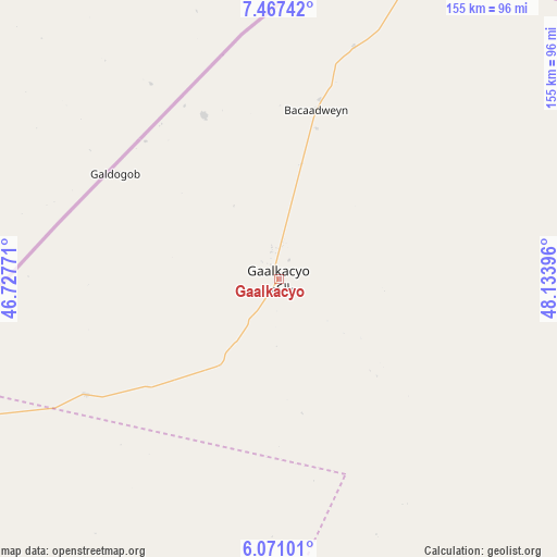
Gaalkacyo GPS coordinates[2]
6° 46' 10.992" North, 47° 25' 50.988" East
| Map corner | latitude | longitude |
|---|---|---|
| Upper-left | 7.46742°, | 46.72771° |
| Center: | 6.76972°, | 47.43083° |
| Lower-right: | 6.07101°, | 48.13396° |
| Map W x H: | 155.3×155.3 km | = 96.5×96.5mi |
| max Lat: | 11.96611° ⇑37.7% North |
| Gaalkacyo: | 6.76972° |
| min Lat: | ⇓62.3% South -1.21917° |
| min Long | Gaalkacyo | max Long |
| 41.83725° | 47.43083° | 51.0773° |
| W 77.4%⇐ | ⇒22.6% E |
Elevation
Elevation of Gaalkacyo is 288 m = 945 ft, and this is 1.9 m = 6 ft below average elevation for this country.
| Max E: |
1786 m = 5860 ft | 28.3% |
| Avg. | 289.9 m = 951 ft | |
| Gaalkacyo | 288 m = 945 ft | |
Min E: |
-2 m = -7 ft | 71.7% |
See also: Gaalkacyo elevation on elevation.city.
Geographical zone
Gaalkacyo is located in North Torrid zone (between Equator and Tropic of Cancer). Distance of Equator is 752.7 km =467.7 mi to South.| Distance of | km | miles | from Gaalkacyo |
|---|---|---|---|
| North Pole | 9254.3 | 5750.4 | to North |
| Arctic Circle | 6648.5 | 4131.2 | to North |
| Tropic Cancer | 1853.2 | 1151.5 | to North |
| Equator | 752.7 | 467.7 | to South |


Nearby cities:
15 places around Gaalkacyo: (largest is in red/bold)
• Adado
113.3 km =70.4 mi,  231°
231°
• Beledweyne
334.4 km =207.8 mi, 227°
• Burao
370.5 km =230.2 mi,  325°
325°
• Buulobarde
384.3 km =238.8 mi,  212°
212°
• Ceek
337 km =209.4 mi,  317°
317°
• Ceelbuur
248.6 km =154.5 mi,  201°
201°
• Ceeldheer
326 km =202.6 mi,  184°
184°
• Ceerigaabo
427.7 km =265.8 mi,  359°
359°
• Dhuusamarreeb
179.3 km =111.4 mi,  220°
220°
• Eyl
295.5 km =183.6 mi,  62°
62°
• Garoowe
215.4 km =133.8 mi,  32°
32°
• Hobyo
199 km =123.7 mi,  142°
142°
• Laascaanood
190 km =118.1 mi, 357°
• Oodweyne
392.4 km =243.8 mi, 318°
• Xarardheere
239.9 km =149.1 mi,  168°
168°
In other languages:
- In France: Gaal Kacyo
- In Italian: Gallacaio
- In Russian: Галькайо
- In Chinese: 加勒卡約
Sources, notices
• [Note1] Compared only with cities in Somalia existing in our database
• [Src1] Map data: © OpenStreetMap contributors (CC-BY-SA)
• [Src2] Other city data from geonames.org with taken over terms of usage.
• [Src3] Geographical zone / Annual Mean Temperature by Robert A. Rohde @ Wikipedia
