Kapoeta geodata
Kapoeta is a seat of a first-order administrative division; located in South Sudan in Africa/Juba (GMT+2) time zone. With population of 7,042 people, there are 17 cities with bigger population in this country. Compared to other cities in South Sudan, 87.9% of cities are located further ↑North; 97% of cities are located further ←West and 90.9% of cities have lower elevation than Kapoeta. Note1


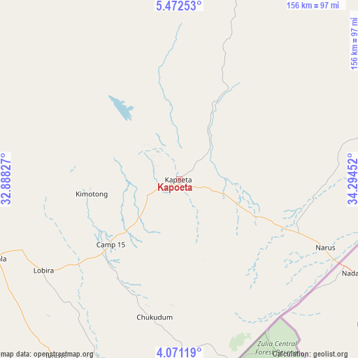
Kapoeta GPS coordinates[2]
4° 46' 19.992" North, 33° 35' 29.004" East
| Map corner | latitude | longitude |
|---|---|---|
| Upper-left | 5.47253°, | 32.88827° |
| Center: | 4.77222°, | 33.59139° |
| Lower-right: | 4.07119°, | 34.29452° |
| Map W x H: | 155.8×155.8 km | = 96.8×96.8mi |
| max Lat: | 11.7431° ⇑87.9% North |
| Kapoeta: | 4.77222° |
| min Lat: | ⇓12.1% South 3.86512° |
| min Long | Kapoeta | max Long |
| 25.67833° | 33.59139° | 33.92621° |
| W 97%⇐ | ⇒3% E |
Elevation
Elevation of Kapoeta is 668 m = 2192 ft, and this is 179.1 m = 588 ft above average elevation for this country.
| Max E: |
836 m = 2743 ft | 9.1% |
| Kapoeta | 668 m 2192 ft | |
| Avg. | 488.9 m = 1604 ft | |
Min E: |
392 m = 1286 ft | 90.9% |
See also: South Sudan elevation on elevation.city.
Geographical zone
Kapoeta is located in North Torrid zone (between Equator and Tropic of Cancer). Distance of Equator is 530.6 km =329.7 mi to South.| Distance of | km | miles | from Kapoeta |
|---|---|---|---|
| North Pole | 9476.4 | 5888.4 | to North |
| Arctic Circle | 6870.6 | 4269.2 | to North |
| Tropic Cancer | 2075.3 | 1289.5 | to North |
| Equator | 530.6 | 329.7 | to South |


Nearby cities:
14 places around Kapoeta: (largest is in red/bold)
• Akobo
341.9 km =212.4 mi,  349°
349°
• Ayod
443.7 km =275.7 mi,  327°
327°
• Bor
275.9 km =171.4 mi,  305°
305°
• Juba
222.8 km =138.4 mi,  272°
272°
• Maiwut
428.3 km =266.1 mi,  4°
4°
• Mundri
367.4 km =228.3 mi,  280°
280°
• Nasir
431.4 km =268.1 mi, 352°
• Pajok
159.1 km =98.9 mi,  230°
230°
• Pibor
231 km =143.5 mi, 347°
• Terekeka
217.1 km =134.9 mi,  290°
290°
• Torit
120 km =74.6 mi,  250°
250°
• Waat
410.8 km =255.3 mi,  337°
337°
• Yei
331.8 km =206.2 mi,  256°
256°
• Yirol
395.4 km =245.7 mi,  300°
300°
Sources, notices
• [Note1] Compared only with cities in South Sudan existing in our database
• [Src1] Map data: © OpenStreetMap contributors (CC-BY-SA)
• [Src2] Other city data from geonames.org with taken over terms of usage.
• [Src3] Geographical zone / Annual Mean Temperature by Robert A. Rohde @ Wikipedia
