Bor geodata
Bor (Jonglei) is a seat of a first-order administrative division; located in South Sudan in Africa/Juba (GMT+2) time zone. With population of 26,782 people, there are 10 cities with bigger population in this country. Compared to other cities in South Sudan, 69.7% of cities are located further ↑North; 60.6% of cities are located further ←West and 54.5% of cities have lower elevation than Bor. Note1


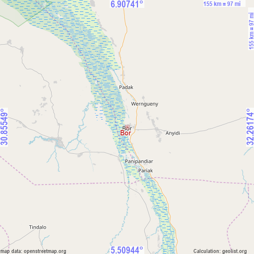
Bor GPS coordinates[2]
6° 12' 32.004" North, 31° 33' 30.996" East
| Map corner | latitude | longitude |
|---|---|---|
| Upper-left | 6.90741°, | 30.85549° |
| Center: | 6.20889°, | 31.55861° |
| Lower-right: | 5.50944°, | 32.26174° |
| Map W x H: | 155.4×155.4 km | = 96.6×96.6mi |
| max Lat: | 11.7431° ⇑69.7% North |
| Bor: | 6.20889° |
| min Lat: | ⇓30.3% South 3.86512° |
| min Long | Bor | max Long |
| 25.67833° | 31.55861° | 33.92621° |
| W 60.6%⇐ | ⇒39.4% E |
Elevation
Elevation of Bor is 429 m = 1407 ft, and this is 59.9 m = 197 ft below average elevation for this country.
| Max E: |
836 m = 2743 ft | 45.5% |
| Avg. | 488.9 m = 1604 ft | |
| Bor | 429 m = 1407 ft | |
Min E: |
392 m = 1286 ft | 54.5% |
See also: South Sudan elevation on elevation.city.
Geographical zone
Bor is located in North Torrid zone (between Equator and Tropic of Cancer). Distance of Equator is 690.4 km =429 mi to South.| Distance of | km | miles | from Bor |
|---|---|---|---|
| North Pole | 9316.7 | 5789.1 | to North |
| Arctic Circle | 6710.8 | 4169.9 | to North |
| Tropic Cancer | 1915.6 | 1190.3 | to North |
| Equator | 690.4 | 429 | to South |


Nearby cities:
15 places around Bor: (largest is in red/bold)
• Akobo
237.5 km =147.6 mi,  42°
42°
• Ayod
213.3 km =132.5 mi,  355°
355°
• Cueibet
271.1 km =168.5 mi,  289°
289°
• Juba
150.9 km =93.8 mi,  178°
178°
• Kapoeta
275.9 km =171.4 mi,  125°
125°
• Maridi
272.2 km =169.1 mi,  238°
238°
• Mundri
166.8 km =103.6 mi,  234°
234°
• Pajok
280 km =174 mi,  158°
158°
• Pibor
185.6 km =115.3 mi,  69°
69°
• Rumbek
218.2 km =135.6 mi, 287°
• Terekeka
87.7 km =54.5 mi,  165°
165°
• Torit
229.1 km =142.4 mi,  150°
150°
• Waat
228.7 km =142.1 mi,  16°
16°
• Yei
254.6 km =158.2 mi,  202°
202°
• Yirol
123.3 km =76.6 mi, 288°
Sources, notices
• [Note1] Compared only with cities in South Sudan existing in our database
• [Src1] Map data: © OpenStreetMap contributors (CC-BY-SA)
• [Src2] Other city data from geonames.org with taken over terms of usage.
• [Src3] Geographical zone / Annual Mean Temperature by Robert A. Rohde @ Wikipedia
