Nhlangano geodata
Nhlangano (Shiselweni) is a seat of a first-order administrative division; located in Eswatini in Africa/Mbabane (GMT+2) time zone. With population of 9,016 people, there are 4 cities with bigger population in this country. Compared to other cities in Eswatini, 90.9% of cities are located further ↑North; 72.7% of cities are located further →East and 77.3% of cities have lower elevation than Nhlangano. Note1


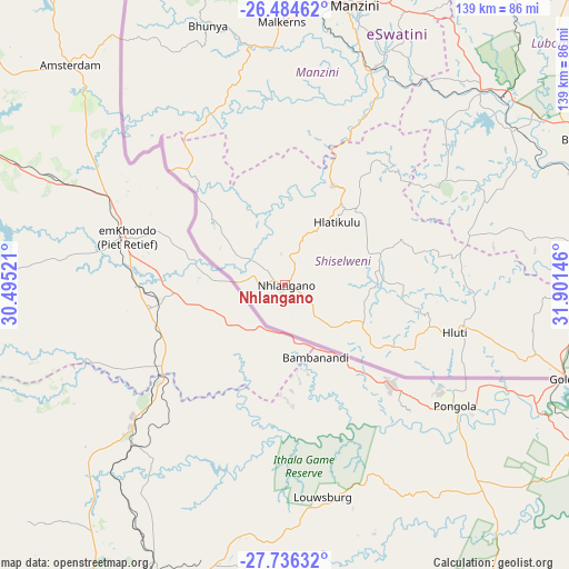
Nhlangano GPS coordinates[2]
27° 6' 43.992" South, 31° 11' 53.988" East
| Map corner | latitude | longitude |
|---|---|---|
| Upper-left | -26.48462°, | 30.49521° |
| Center: | -27.11222°, | 31.19833° |
| Lower-right: | -27.73632°, | 31.90146° |
| Map W x H: | 139.2×139.2 km | = 86.5×86.5mi |
| max Lat: | -25.82659° ⇑90.9% North |
| Nhlangano: | -27.11222° |
| min Lat: | ⇓9.1% South -27.31005° |
| min Long | Nhlangano | max Long |
| 31.01667° | 31.19833° | 31.95° |
| W 27.3%⇐ | ⇒72.7% E |
Elevation
Elevation of Nhlangano is 1075 m = 3527 ft, and this is 396.5 m = 1301 ft above average elevation for this country.
| Max E: |
1317 m = 4321 ft | 22.7% |
| Nhlangano | 1075 m 3527 ft | |
| Avg. | 678.5 m = 2226 ft | |
Min E: |
109 m = 358 ft | 77.3% |
See also: Eswatini elevation on elevation.city.
Geographical zone
Nhlangano is located in South temperate zone (between Tropic of Capricorn and the Antarctic Circle). Distance of this Southern Tropic circle is 408.7 km =254 mi to North.| Distance of | km | miles | from Nhlangano |
|---|---|---|---|
| Equator | 3014.6 | 1873.2 | to North |
| Tropic Capricorn | 408.7 | 254 | to North |
| Antarctic Circle | 4386.6 | 2725.7 | to South |
| South Pole | 6992.5 | 4344.9 | to South |


Nearby cities:
15 places around Nhlangano: (largest is in red/bold)
• Bhunya
65.1 km =40.5 mi,  343°
343°
• Big Bend
79.9 km =49.6 mi,  65°
65°
• Darkton
99.1 km =61.6 mi,  350°
350°
• Hlatikulu
19.4 km =12.1 mi,  40°
40°
• Hluti
43 km =26.7 mi,  105°
105°
• Kubuta
38 km =23.6 mi,  47°
47°
• Kwaluseni
71.2 km =44.2 mi,  10°
10°
• Lavumisa
72 km =44.7 mi, 107°
• Lobamba
71.8 km =44.6 mi,  0°
0°
• Malkerns
60.7 km =37.7 mi,  358°
358°
• Manzini
70.5 km =43.8 mi, 14°
• Mbabane
88.7 km =55.1 mi, 355°
• Mhlambanyatsi
75.8 km =47.1 mi, 346°
• Nsoko
74.9 km =46.5 mi,  83°
83°
• Sidvokodvo
58.1 km =36.1 mi,  22°
22°
Sources, notices
• [Note1] Compared only with cities in Eswatini existing in our database
• [Src1] Map data: © OpenStreetMap contributors (CC-BY-SA)
• [Src2] Other city data from geonames.org with taken over terms of usage.
• [Src3] Geographical zone / Annual Mean Temperature by Robert A. Rohde @ Wikipedia
