Darkton geodata
Darkton is a populated place; located in Eswatini in Africa/Mbabane (GMT+2) time zone. With population of 1,281 people, there are 20 cities with bigger population in this country. Compared to other cities in Eswatini, 72.7% of cities are located further ↓South; 90.9% of cities are located further →East and 95.5% of cities have lower elevation than Darkton. Note1


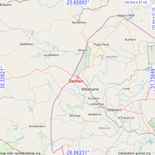
Darkton GPS coordinates[2]
26° 13' 59.988" South, 31° 1' 59.988" East
| Map corner | latitude | longitude |
|---|---|---|
| Upper-left | -25.60093°, | 30.33021° |
| Center: | -26.23333°, | 31.03333° |
| Lower-right: | -26.86231°, | 31.73646° |
| Map W x H: | 140.3×140.3 km | = 87.2×87.2mi |
| max Lat: | -25.82659° ⇑27.3% North |
| Darkton: | -26.23333° |
| min Lat: | ⇓72.7% South -27.31005° |
| min Long | Darkton | max Long |
| 31.01667° | 31.03333° | 31.95° |
| W 9.1%⇐ | ⇒90.9% E |
Elevation
Elevation of Darkton is 1308 m = 4291 ft, and this is 629.5 m = 2065 ft above average elevation for this country.
| Max E: |
1317 m = 4321 ft | 4.5% |
| Darkton | 1308 m 4291 ft | |
| Avg. | 678.5 m = 2226 ft | |
Min E: |
109 m = 358 ft | 95.5% |
See also: Eswatini elevation on elevation.city.
Geographical zone
Darkton is located in South temperate zone (between Tropic of Capricorn and the Antarctic Circle). Distance of this Southern Tropic circle is 311 km =193.2 mi to North.| Distance of | km | miles | from Darkton |
|---|---|---|---|
| Equator | 2916.9 | 1812.5 | to North |
| Tropic Capricorn | 311 | 193.2 | to North |
| Antarctic Circle | 4484.3 | 2786.4 | to South |
| South Pole | 7090.2 | 4405.6 | to South |


Nearby cities:
15 places around Darkton: (largest is in red/bold)
• Bhunya
35.2 km =21.9 mi,  182°
182°
• Bulembu
31.3 km =19.4 mi,  18°
18°
• Kubuta
85 km =52.8 mi,  148°
148°
• Kwaluseni
40.8 km =25.4 mi,  132°
132°
• Lobamba
30.8 km =19.1 mi, 147°
• Malkerns
40 km =24.9 mi,  158°
158°
• Manzini
45.4 km =28.2 mi, 130°
• Mbabane
13.6 km =8.5 mi, 132°
• Mhlambanyatsi
24.1 km =15 mi, 183°
• Mhlume
84.5 km =52.5 mi,  74°
74°
• Ntfonjeni
53.9 km =33.5 mi,  33°
33°
• Piggs Peak
37 km =23 mi,  35°
35°
• Sidvokodvo
58.4 km =36.3 mi,  138°
138°
• Tshaneni
73.7 km =45.8 mi, 67°
• Vuvulane
86 km =53.4 mi,  78°
78°
Sources, notices
• [Note1] Compared only with cities in Eswatini existing in our database
• [Src1] Map data: © OpenStreetMap contributors (CC-BY-SA)
• [Src2] Other city data from geonames.org with taken over terms of usage.
• [Src3] Geographical zone / Annual Mean Temperature by Robert A. Rohde @ Wikipedia
