Biltine geodata
Biltine (Wadi Fira) is a seat of a first-order administrative division; located in Chad in Africa/Ndjamena (GMT+1) time zone. With population of 11,000 people, there are 34 cities with bigger population in this country. Compared to other cities in Chad, 87.2% of cities are located further ↓South; 89.4% of cities are located further ←West and 83% of cities have lower elevation than Biltine. Note1


Biltine GPS coordinates[2]
14° 31' 40.476" North, 20° 55' 38.964" East
| Map corner | latitude | longitude |
|---|---|---|
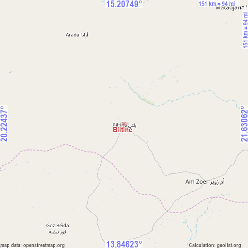
| Upper-left | 15.20749°, | 20.22437° |
| Center: | 14.52791°, | 20.92749° |
| Lower-right: | 13.84623°, | 21.63062° |
| Map W x H: | 151.4×151.4 km | = 94.1×94.1mi |
| max Lat: | 21.8375° ⇑12.8% North |
| Biltine: | 14.52791° |
| min Lat: | ⇓87.2% South 8.26681° |
| min Long | Biltine | max Long |
| 14.1539° | 20.92749° | 22.84308° |
| W 89.4%⇐ | ⇒10.6% E |
Elevation
Elevation of Biltine is 517 m = 1696 ft, and this is 79.7 m = 261 ft above average elevation for this country.
| Max E: |
1046 m = 3432 ft | 17% |
| Biltine | 517 m 1696 ft | |
| Avg. | 437.3 m = 1435 ft | |
Min E: |
242 m = 794 ft | 83% |
See also: Chad elevation on elevation.city.
Geographical zone
Biltine is located in North Torrid zone (between Equator and Tropic of Cancer). Distance of this Northern Tropic circle is 990.6 km =615.5 mi to North.| Distance of | km | miles | from Biltine |
|---|---|---|---|
| North Pole | 8391.7 | 5214.4 | to North |
| Arctic Circle | 5785.8 | 3595.1 | to North |
| Tropic Cancer | 990.6 | 615.5 | to North |
| Equator | 1615.4 | 1003.8 | to South |


Nearby cities:
13 places around Biltine: (largest is in red/bold)
• Abéché
78.4 km =48.7 mi,  187°
187°
• Adré
180.9 km =112.4 mi,  130°
130°
• Am Djarass
267.3 km =166.1 mi,  50°
50°
• Am Timan
395.2 km =245.6 mi, 190°
• Ati
315.6 km =196.1 mi,  242°
242°
• Bitkine
408 km =253.5 mi,  226°
226°
• Fada
303.6 km =188.6 mi,  13°
13°
• Faya-Largeau
425 km =264.1 mi,  332°
332°
• Goz Beïda
261.3 km =162.4 mi,  168°
168°
• Goz Béïda
76.6 km =47.6 mi,  212°
212°
• Iriba
156.5 km =97.2 mi,  65°
65°
• Mongo
355.4 km =220.8 mi,  222°
222°
• Oum Hadjer
190.9 km =118.6 mi, 224°
Sources, notices
• [Note1] Compared only with cities in Chad existing in our database
• [Src1] Map data: © OpenStreetMap contributors (CC-BY-SA)
• [Src2] Other city data from geonames.org with taken over terms of usage.
• [Src3] Geographical zone / Annual Mean Temperature by Robert A. Rohde @ Wikipedia
