Oum Hadjer geodata
Oum Hadjer (Batha) is a populated place; located in Chad in Africa/Ndjamena (GMT+1) time zone. With population of 19,271 people, there are 14 cities with bigger population in this country. Compared to other cities in Chad, 70.2% of cities are located further ↓South; 80.9% of cities are located further ←West and 57.4% of cities have lower elevation than Oum Hadjer. Note1


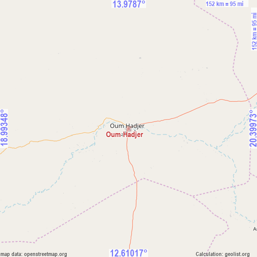
Oum Hadjer GPS coordinates[2]
13° 17' 43.44" North, 19° 41' 47.76" East
| Map corner | latitude | longitude |
|---|---|---|
| Upper-left | 13.9787°, | 18.99348° |
| Center: | 13.2954°, | 19.6966° |
| Lower-right: | 12.61017°, | 20.39973° |
| Map W x H: | 152.2×152.2 km | = 94.6×94.6mi |
| max Lat: | 21.8375° ⇑29.8% North |
| Oum Hadjer: | 13.2954° |
| min Lat: | ⇓70.2% South 8.26681° |
| min Long | Oum Hadjer | max Long |
| 14.1539° | 19.6966° | 22.84308° |
| W 80.9%⇐ | ⇒19.1% E |
Elevation
Elevation of Oum Hadjer is 397 m = 1302 ft, and this is 40.3 m = 132 ft below average elevation for this country.
| Max E: |
1046 m = 3432 ft | 42.6% |
| Avg. | 437.3 m = 1435 ft | |
| Oum Hadjer | 397 m = 1302 ft | |
Min E: |
242 m = 794 ft | 57.4% |
See also: Chad elevation on elevation.city.
Geographical zone
Oum Hadjer is located in North Torrid zone (between Equator and Tropic of Cancer). Distance of this Northern Tropic circle is 1127.6 km =700.7 mi to North.| Distance of | km | miles | from Oum Hadjer |
|---|---|---|---|
| North Pole | 8528.8 | 5299.5 | to North |
| Arctic Circle | 5922.9 | 3680.3 | to North |
| Tropic Cancer | 1127.6 | 700.7 | to North |
| Equator | 1478.3 | 918.6 | to South |


Nearby cities:
15 places around Oum Hadjer: (largest is in red/bold)
• Abéché
136.4 km =84.8 mi,  64°
64°
• Adré
271.3 km =168.6 mi,  85°
85°
• Am Timan
259.9 km =161.5 mi,  165°
165°
• Ati
147.6 km =91.7 mi,  266°
266°
• Biltine
190.9 km =118.6 mi,  44°
44°
• Bitkine
217.4 km =135.1 mi,  227°
227°
• Bokoro
303.6 km =188.6 mi,  250°
250°
• Goz Beïda
220.7 km =137.1 mi,  122°
122°
• Goz Béïda
116.9 km =72.6 mi,  51°
51°
• Iriba
341.7 km =212.3 mi, 53°
• Massakory
430.8 km =267.7 mi, 265°
• Melfi
313.7 km =194.9 mi,  217°
217°
• Mongo
164.6 km =102.3 mi, 221°
• Moussoro
348.9 km =216.8 mi,  276°
276°
• Ngama
322 km =200.1 mi,  238°
238°
Sources, notices
• [Note1] Compared only with cities in Chad existing in our database
• [Src1] Map data: © OpenStreetMap contributors (CC-BY-SA)
• [Src2] Other city data from geonames.org with taken over terms of usage.
• [Src3] Geographical zone / Annual Mean Temperature by Robert A. Rohde @ Wikipedia
