Tha Sae geodata
Tha Sae (Chumphon) is a seat of a second-order administrative division; located in Thailand in Asia/Bangkok (GMT+7) time zone. In our database, there are 331 cities with bigger population. Compared to other cities in Thailand, 82.2% of cities are located further ↑North; 89.5% of cities are located further →East and 70.3% of cities have higher elevation than Tha Sae. Note1


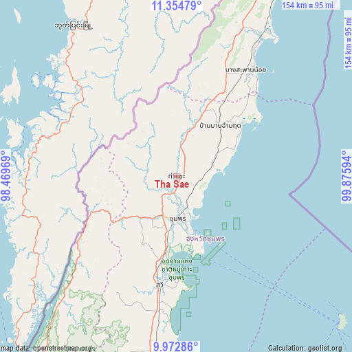
Tha Sae GPS coordinates[2]
10° 39' 52.596" North, 99° 10' 22.116" East
| Map corner | latitude | longitude |
|---|---|---|
| Upper-left | 11.35479°, | 98.46969° |
| Center: | 10.66461°, | 99.17281° |
| Lower-right: | 9.97286°, | 99.87594° |
| Map W x H: | 153.7×153.7 km | = 95.5×95.5mi |
| max Lat: | 20.43353° ⇑82.2% North |
| Tha Sae: | 10.66461° |
| min Lat: | ⇓17.8% South 5.77434° |
| min Long | Tha Sae | max Long |
| 97.93288° | 99.17281° | 105.49506° |
| W 10.5%⇐ | ⇒89.5% E |
Elevation
Elevation of Tha Sae is 22 m = 72 ft, and this is 103.5 m = 340 ft below average elevation for this country.
| Max E: |
1011 m = 3317 ft | 70.3% |
| Avg. | 125.5 m = 412 ft | |
| Tha Sae | 22 m = 72 ft | |
Min E: |
1 m = 3 ft | 29.7% |
See also: Thailand elevation on elevation.city.
Geographical zone
Tha Sae is located in North Torrid zone (between Equator and Tropic of Cancer). Distance of Equator is 1185.8 km =736.8 mi to South.| Distance of | km | miles | from Tha Sae |
|---|---|---|---|
| North Pole | 8821.3 | 5481.3 | to North |
| Arctic Circle | 6215.4 | 3862.1 | to North |
| Tropic Cancer | 1420.1 | 882.4 | to North |
| Equator | 1185.8 | 736.8 | to South |


Nearby cities:
15 places around Tha Sae: (largest is in red/bold)
• Ban Nam Yuen
93.8 km =58.3 mi,  200°
200°
• Bang Saphan
71.3 km =44.3 mi,  31°
31°
• Bang Saphan Noi
54.3 km =33.7 mi, 32°
• Chumphon
18.8 km =11.7 mi,  177°
177°
• Koh Tao
96.2 km =59.8 mi,  130°
130°
• Kra Buri
52.5 km =32.6 mi,  236°
236°
• La-Un
76.5 km =47.5 mi,  217°
217°
• Lamae
100.1 km =62.2 mi,  185°
185°
• Lang Suan
80.6 km =50.1 mi, 187°
• Pathio
16.6 km =10.3 mi,  72°
72°
• Phato
106.4 km =66.1 mi, 204°
• Ranong
97.5 km =60.6 mi, 217°
• Sawi
48.1 km =29.9 mi, 188°
• Thap Sakae
105 km =65.2 mi, 27°
• Thung Tako
62.4 km =38.8 mi, 189°
Sources, notices
• [Note1] Compared only with cities in Thailand existing in our database
• [Src1] Map data: © OpenStreetMap contributors (CC-BY-SA)
• [Src2] Other city data from geonames.org with taken over terms of usage.
• [Src3] Geographical zone / Annual Mean Temperature by Robert A. Rohde @ Wikipedia
