Thap Sakae geodata
Thap Sakae (Prachuap Khiri Khan) is a seat of a second-order administrative division; located in Thailand in Asia/Bangkok (GMT+7) time zone. In our database, there are 331 cities with bigger population. Compared to other cities in Thailand, 81.8% of cities are located further ↑North; 82.6% of cities are located further →East and 83.5% of cities have higher elevation than Thap Sakae. Note1


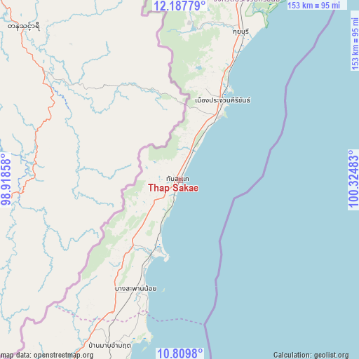
Thap Sakae GPS coordinates[2]
11° 29' 58.704" North, 99° 37' 18.12" East
| Map corner | latitude | longitude |
|---|---|---|
| Upper-left | 12.18779°, | 98.91858° |
| Center: | 11.49964°, | 99.6217° |
| Lower-right: | 10.8098°, | 100.32483° |
| Map W x H: | 153.2×153.2 km | = 95.2×95.2mi |
| max Lat: | 20.43353° ⇑81.8% North |
| Thap Sakae: | 11.49964° |
| min Lat: | ⇓18.2% South 5.77434° |
| min Long | Thap Sakae | max Long |
| 97.93288° | 99.6217° | 105.49506° |
| W 17.4%⇐ | ⇒82.6% E |
Elevation
Elevation of Thap Sakae is 11 m = 36 ft, and this is 114.5 m = 376 ft below average elevation for this country.
| Max E: |
1011 m = 3317 ft | 83.5% |
| Avg. | 125.5 m = 412 ft | |
| Thap Sakae | 11 m = 36 ft | |
Min E: |
1 m = 3 ft | 16.5% |
See also: Thailand elevation on elevation.city.
Geographical zone
Thap Sakae is located in North Torrid zone (between Equator and Tropic of Cancer). Distance of Equator is 1278.6 km =794.5 mi to South.| Distance of | km | miles | from Thap Sakae |
|---|---|---|---|
| North Pole | 8728.4 | 5423.6 | to North |
| Arctic Circle | 6122.5 | 3804.3 | to North |
| Tropic Cancer | 1327.3 | 824.7 | to North |
| Equator | 1278.6 | 794.5 | to South |


Nearby cities:
15 places around Thap Sakae: (largest is in red/bold)
• Bang Saphan
34.1 km =21.2 mi,  200°
200°
• Bang Saphan Noi
51.1 km =31.8 mi, 202°
• Cha-am
149.4 km =92.8 mi,  14°
14°
• Chumphon
121.6 km =75.6 mi, 203°
• Hua Hin
124.6 km =77.4 mi,  17°
17°
• Kaeng Krachan
156.6 km =97.3 mi,  1°
1°
• Koh Tao
157.6 km =97.9 mi,  171°
171°
• Kra Buri
153 km =95.1 mi,  217°
217°
• Kui Buri
69.6 km =43.2 mi, 21°
• Pathio
93.9 km =58.3 mi, 200°
• Prachuap Khiri Khan
39.9 km =24.8 mi,  26°
26°
• Pran Buri
103 km =64 mi, 17°
• Sam Roi Yot
90 km =55.9 mi, 17°
• Sawi
151.2 km =94 mi, 201°
• Tha Sae
105 km =65.2 mi,  207°
207°
Sources, notices
• [Note1] Compared only with cities in Thailand existing in our database
• [Src1] Map data: © OpenStreetMap contributors (CC-BY-SA)
• [Src2] Other city data from geonames.org with taken over terms of usage.
• [Src3] Geographical zone / Annual Mean Temperature by Robert A. Rohde @ Wikipedia
