Pathio geodata
Pathio (Chumphon) is a seat of a second-order administrative division; located in Thailand in Asia/Bangkok (GMT+7) time zone. In our database, there are 331 cities with bigger population. Compared to other cities in Thailand, 82.1% of cities are located further ↑North; 87.8% of cities are located further →East and 78.4% of cities have higher elevation than Pathio. Note1


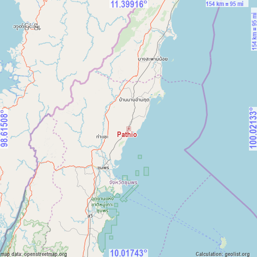
Pathio GPS coordinates[2]
10° 42' 32.688" North, 99° 19' 5.52" East
| Map corner | latitude | longitude |
|---|---|---|
| Upper-left | 11.39916°, | 98.61508° |
| Center: | 10.70908°, | 99.3182° |
| Lower-right: | 10.01743°, | 100.02133° |
| Map W x H: | 153.6×153.6 km | = 95.4×95.4mi |
| max Lat: | 20.43353° ⇑82.1% North |
| Pathio: | 10.70908° |
| min Lat: | ⇓17.9% South 5.77434° |
| min Long | Pathio | max Long |
| 97.93288° | 99.3182° | 105.49506° |
| W 12.2%⇐ | ⇒87.8% E |
Elevation
Elevation of Pathio is 13 m = 43 ft, and this is 112.5 m = 369 ft below average elevation for this country.
| Max E: |
1011 m = 3317 ft | 78.4% |
| Avg. | 125.5 m = 412 ft | |
| Pathio | 13 m = 43 ft | |
Min E: |
1 m = 3 ft | 21.6% |
See also: Thailand elevation on elevation.city.
Geographical zone
Pathio is located in North Torrid zone (between Equator and Tropic of Cancer). Distance of Equator is 1190.7 km =739.9 mi to South.| Distance of | km | miles | from Pathio |
|---|---|---|---|
| North Pole | 8816.3 | 5478.2 | to North |
| Arctic Circle | 6210.4 | 3859 | to North |
| Tropic Cancer | 1415.2 | 879.4 | to North |
| Equator | 1190.7 | 739.9 | to South |


Nearby cities:
15 places around Pathio: (largest is in red/bold)
• Ban Nam Yuen
104.9 km =65.2 mi,  208°
208°
• Bang Saphan
59.8 km =37.2 mi,  20°
20°
• Bang Saphan Noi
42.9 km =26.7 mi, 18°
• Chumphon
28.1 km =17.5 mi, 212°
• Koh Tao
88.6 km =55.1 mi,  140°
140°
• Kra Buri
68.6 km =42.6 mi,  240°
240°
• La-Un
90.6 km =56.3 mi,  223°
223°
• Lamae
107.5 km =66.8 mi,  193°
193°
• Lang Suan
88.8 km =55.2 mi,  197°
197°
• Phato
118 km =73.3 mi, 210°
• Ranong
111.4 km =69.2 mi, 222°
• Sawi
57.3 km =35.6 mi, 203°
• Tha Sae
16.6 km =10.3 mi,  252°
252°
• Thap Sakae
93.9 km =58.3 mi, 20°
• Thung Tako
71.4 km =44.4 mi, 201°
Sources, notices
• [Note1] Compared only with cities in Thailand existing in our database
• [Src1] Map data: © OpenStreetMap contributors (CC-BY-SA)
• [Src2] Other city data from geonames.org with taken over terms of usage.
• [Src3] Geographical zone / Annual Mean Temperature by Robert A. Rohde @ Wikipedia
