Uttaradit geodata
Uttaradit is a seat of a first-order administrative division; located in Thailand in Asia/Bangkok (GMT+7) time zone. With population of 58,313 people, there are 42 cities with bigger population in this country. Compared to other cities in Thailand, 85.3% of cities are located further ↓South; 69.7% of cities are located further →East and 52.7% of cities have higher elevation than Uttaradit. Note1


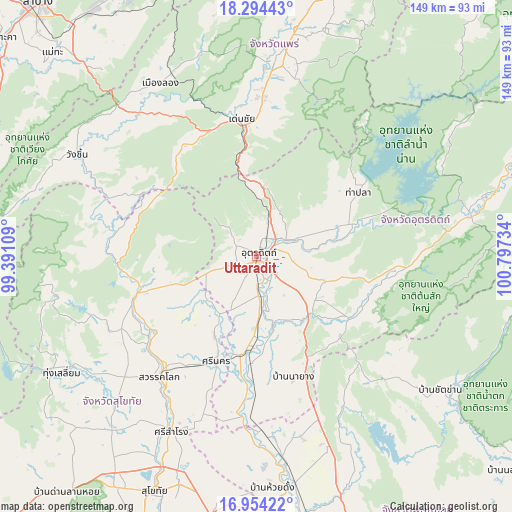
Uttaradit GPS coordinates[2]
17° 37' 32.052" North, 100° 5' 39.156" East
| Map corner | latitude | longitude |
|---|---|---|
| Upper-left | 18.29443°, | 99.39109° |
| Center: | 17.62557°, | 100.09421° |
| Lower-right: | 16.95422°, | 100.79734° |
| Map W x H: | 149×149 km | = 92.6×92.6mi |
| max Lat: | 20.43353° ⇑14.7% North |
| Uttaradit: | 17.62557° |
| min Lat: | ⇓85.3% South 5.77434° |
| min Long | Uttaradit | max Long |
| 97.93288° | 100.09421° | 105.49506° |
| W 30.3%⇐ | ⇒69.7% E |
Elevation
Elevation of Uttaradit is 68 m = 223 ft, and this is 57.5 m = 189 ft below average elevation for this country.
| Max E: |
1011 m = 3317 ft | 52.7% |
| Avg. | 125.5 m = 412 ft | |
| Uttaradit | 68 m = 223 ft | |
Min E: |
1 m = 3 ft | 47.3% |
See also: Uttaradit elevation on elevation.city.
Geographical zone
Uttaradit is located in North Torrid zone (between Equator and Tropic of Cancer). Distance of this Northern Tropic circle is 646.1 km =401.5 mi to North.| Distance of | km | miles | from Uttaradit |
|---|---|---|---|
| North Pole | 8047.3 | 5000.4 | to North |
| Arctic Circle | 5441.4 | 3381.1 | to North |
| Tropic Cancer | 646.1 | 401.5 | to North |
| Equator | 1959.8 | 1217.8 | to South |


Nearby cities:
15 places around Uttaradit: (largest is in red/bold)
• Den Chai
40.1 km =24.9 mi,  353°
353°
• Lap Lae
6.6 km =4.1 mi,  296°
296°
• Laplae
6.6 km =4.1 mi, 296°
• Long
57.2 km =35.5 mi,  330°
330°
• Phichai
37.6 km =23.4 mi,  181°
181°
• Phrae
58.1 km =36.1 mi,  4°
4°
• Sawankhalok
44.3 km =27.5 mi,  218°
218°
• Si Nakhon
32.8 km =20.4 mi,  200°
200°
• Si Samrong
56.9 km =35.4 mi,  205°
205°
• Si Satchanalai
37.5 km =23.3 mi,  251°
251°
• Sung Men
47.2 km =29.3 mi, 2°
• Tha Pla
35.1 km =21.8 mi,  58°
58°
• Thong Saen Khan
30.5 km =19 mi,  124°
124°
• Tron
16.1 km =10 mi,  172°
172°
• Wang Chin
58.5 km =36.4 mi, 298°
Sources, notices
• [Note1] Compared only with cities in Thailand existing in our database
• [Src1] Map data: © OpenStreetMap contributors (CC-BY-SA)
• [Src2] Other city data from geonames.org with taken over terms of usage.
• [Src3] Geographical zone / Annual Mean Temperature by Robert A. Rohde @ Wikipedia
