Lap Lae geodata
Lap Lae (Uttaradit) is a seat of a second-order administrative division; located in Thailand in Asia/Bangkok (GMT+7) time zone. In our database, there are 331 cities with bigger population. Compared to other cities in Thailand, 85.6% of cities are located further ↓South; 71.4% of cities are located further →East and 50.9% of cities have higher elevation than Lap Lae. Note1


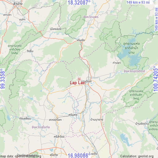
Lap Lae GPS coordinates[2]
17° 39' 7.596" North, 100° 2' 20.112" East
| Map corner | latitude | longitude |
|---|---|---|
| Upper-left | 18.32087°, | 99.3358° |
| Center: | 17.65211°, | 100.03892° |
| Lower-right: | 16.98086°, | 100.74205° |
| Map W x H: | 149×149 km | = 92.6×92.6mi |
| max Lat: | 20.43353° ⇑14.4% North |
| Lap Lae: | 17.65211° |
| min Lat: | ⇓85.6% South 5.77434° |
| min Long | Lap Lae | max Long |
| 97.93288° | 100.03892° | 105.49506° |
| W 28.6%⇐ | ⇒71.4% E |
Elevation
Elevation of Lap Lae is 85 m = 279 ft, and this is 40.5 m = 133 ft below average elevation for this country.
| Max E: |
1011 m = 3317 ft | 50.9% |
| Avg. | 125.5 m = 412 ft | |
| Lap Lae | 85 m = 279 ft | |
Min E: |
1 m = 3 ft | 49.1% |
See also: Thailand elevation on elevation.city.
Geographical zone
Lap Lae is located in North Torrid zone (between Equator and Tropic of Cancer). Distance of this Northern Tropic circle is 643.2 km =399.7 mi to North.| Distance of | km | miles | from Lap Lae |
|---|---|---|---|
| North Pole | 8044.3 | 4998.5 | to North |
| Arctic Circle | 5438.4 | 3379.3 | to North |
| Tropic Cancer | 643.2 | 399.7 | to North |
| Equator | 1962.7 | 1219.6 | to South |


Nearby cities:
15 places around Lap Lae: (largest is in red/bold)
• Den Chai
36.9 km =22.9 mi,  2°
2°
• Laplae
0 km =0 mi, 0°
• Long
51.8 km =32.2 mi,  334°
334°
• Phichai
40.8 km =25.4 mi,  172°
172°
• Phrae
56 km =34.8 mi,  11°
11°
• Sawankhalok
43.3 km =26.9 mi,  210°
210°
• Si Nakhon
34.2 km =21.3 mi,  189°
189°
• Si Samrong
57.4 km =35.7 mi,  199°
199°
• Si Satchanalai
33.2 km =20.6 mi,  243°
243°
• Sung Men
44.9 km =27.9 mi, 10°
• Tha Pla
38.9 km =24.2 mi,  66°
66°
• Thong Saen Khan
37 km =23 mi,  123°
123°
• Tron
20.5 km =12.7 mi,  157°
157°
• Uttaradit
6.6 km =4.1 mi, 116°
• Wang Chin
52 km =32.3 mi,  299°
299°
Sources, notices
• [Note1] Compared only with cities in Thailand existing in our database
• [Src1] Map data: © OpenStreetMap contributors (CC-BY-SA)
• [Src2] Other city data from geonames.org with taken over terms of usage.
• [Src3] Geographical zone / Annual Mean Temperature by Robert A. Rohde @ Wikipedia
