Lom Kao geodata
Lom Kao (Phetchabun) is a seat of a second-order administrative division; located in Thailand in Asia/Bangkok (GMT+7) time zone. In our database, there are 331 cities with bigger population. Compared to other cities in Thailand, 77.1% of cities are located further ↓South; 58% of cities are located further ←West and 67.1% of cities have lower elevation than Lom Kao. Note1


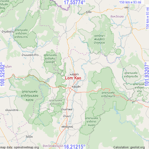
Lom Kao GPS coordinates[2]
16° 53' 10.104" North, 101° 13' 44.184" East
| Map corner | latitude | longitude |
|---|---|---|
| Upper-left | 17.55774°, | 100.52582° |
| Center: | 16.88614°, | 101.22894° |
| Lower-right: | 16.21215°, | 101.93207° |
| Map W x H: | 149.6×149.6 km | = 93×93mi |
| max Lat: | 20.43353° ⇑22.9% North |
| Lom Kao: | 16.88614° |
| min Lat: | ⇓77.1% South 5.77434° |
| min Long | Lom Kao | max Long |
| 97.93288° | 101.22894° | 105.49506° |
| W 58%⇐ | ⇒42% E |
Elevation
Elevation of Lom Kao is 163 m = 535 ft, and this is 37.5 m = 123 ft above average elevation for this country.
| Max E: |
1011 m = 3317 ft | 32.9% |
| Lom Kao | 163 m 535 ft | |
| Avg. | 125.5 m = 412 ft | |
Min E: |
1 m = 3 ft | 67.1% |
See also: Thailand elevation on elevation.city.
Geographical zone
Lom Kao is located in North Torrid zone (between Equator and Tropic of Cancer). Distance of this Northern Tropic circle is 728.4 km =452.6 mi to North.| Distance of | km | miles | from Lom Kao |
|---|---|---|---|
| North Pole | 8129.5 | 5051.4 | to North |
| Arctic Circle | 5523.6 | 3432.2 | to North |
| Tropic Cancer | 728.4 | 452.6 | to North |
| Equator | 1877.6 | 1166.7 | to South |


Nearby cities:
15 places around Lom Kao: (largest is in red/bold)
• Dan Sai
44.7 km =27.8 mi,  348°
348°
• Khao Kho
33.6 km =20.9 mi,  220°
220°
• Lom Sak
11.9 km =7.4 mi,  173°
173°
• Na Haeo
68.8 km =42.8 mi, 345°
• Nakhon Thai
48 km =29.8 mi,  299°
299°
• Nam Nao
48.7 km =30.3 mi,  105°
105°
• Noen Maprang
72.7 km =45.2 mi,  240°
240°
• Nong Hin
71.9 km =44.7 mi,  68°
68°
• Phetchabun
52.4 km =32.6 mi,  187°
187°
• Phu Kradueng
69.8 km =43.4 mi,  90°
90°
• Phu Luang
54.1 km =33.6 mi,  58°
58°
• Phu Pha Man
76.3 km =47.4 mi, 110°
• Phu Ruea
64.7 km =40.2 mi,  12°
12°
• Wang Pong
76.3 km =47.4 mi, 217°
• Wang Saphung
73.6 km =45.7 mi,  51°
51°
Sources, notices
• [Note1] Compared only with cities in Thailand existing in our database
• [Src1] Map data: © OpenStreetMap contributors (CC-BY-SA)
• [Src2] Other city data from geonames.org with taken over terms of usage.
• [Src3] Geographical zone / Annual Mean Temperature by Robert A. Rohde @ Wikipedia
