Lom Sak geodata
Lom Sak (Phetchabun) is a seat of a second-order administrative division; located in Thailand in Asia/Bangkok (GMT+7) time zone. With population of 17,309 people, there are 184 cities with bigger population in this country. Compared to other cities in Thailand, 75.8% of cities are located further ↓South; 58.2% of cities are located further ←West and 59.5% of cities have lower elevation than Lom Sak. Note1


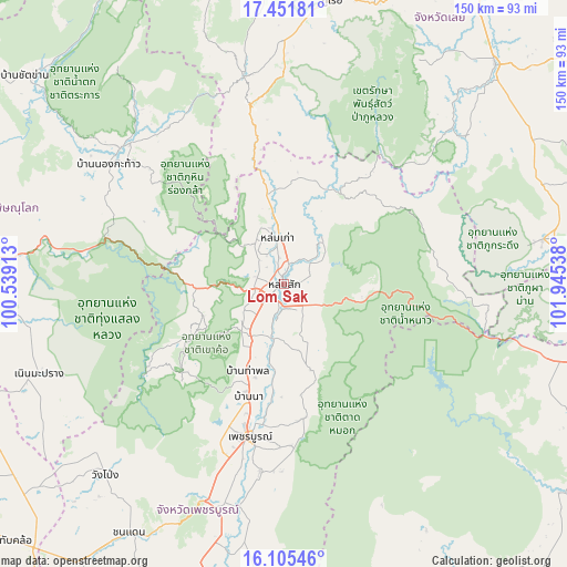
Lom Sak GPS coordinates[2]
16° 46' 47.388" North, 101° 14' 32.1" East
| Map corner | latitude | longitude |
|---|---|---|
| Upper-left | 17.45181°, | 100.53913° |
| Center: | 16.77983°, | 101.24225° |
| Lower-right: | 16.10546°, | 101.94538° |
| Map W x H: | 149.7×149.7 km | = 93×93mi |
| max Lat: | 20.43353° ⇑24.2% North |
| Lom Sak: | 16.77983° |
| min Lat: | ⇓75.8% South 5.77434° |
| min Long | Lom Sak | max Long |
| 97.93288° | 101.24225° | 105.49506° |
| W 58.2%⇐ | ⇒41.8% E |
Elevation
Elevation of Lom Sak is 147 m = 482 ft, and this is 21.5 m = 71 ft above average elevation for this country.
| Max E: |
1011 m = 3317 ft | 40.5% |
| Lom Sak | 147 m 482 ft | |
| Avg. | 125.5 m = 412 ft | |
Min E: |
1 m = 3 ft | 59.5% |
See also: Thailand elevation on elevation.city.
Geographical zone
Lom Sak is located in North Torrid zone (between Equator and Tropic of Cancer). Distance of this Northern Tropic circle is 740.2 km =459.9 mi to North.| Distance of | km | miles | from Lom Sak |
|---|---|---|---|
| North Pole | 8141.3 | 5058.8 | to North |
| Arctic Circle | 5535.4 | 3439.5 | to North |
| Tropic Cancer | 740.2 | 459.9 | to North |
| Equator | 1865.7 | 1159.3 | to South |


Nearby cities:
15 places around Lom Sak: (largest is in red/bold)
• Chon Daen
77.3 km =48 mi,  211°
211°
• Dan Sai
56.5 km =35.1 mi,  349°
349°
• Khao Kho
27.1 km =16.8 mi,  239°
239°
• Khon San
74.5 km =46.3 mi,  104°
104°
• Lom Kao
11.9 km =7.4 mi, 353°
• Nakhon Thai
55.9 km =34.7 mi,  309°
309°
• Nam Nao
45.5 km =28.3 mi,  91°
91°
• Noen Maprang
69.1 km =42.9 mi,  249°
249°
• Nong Hin
75.8 km =47.1 mi,  59°
59°
• Phetchabun
41 km =25.5 mi,  192°
192°
• Phu Kradueng
69.3 km =43.1 mi,  80°
80°
• Phu Luang
60.1 km =37.3 mi,  48°
48°
• Phu Pha Man
71.6 km =44.5 mi, 101°
• Phu Ruea
76 km =47.2 mi,  9°
9°
• Wang Pong
68.3 km =42.4 mi,  224°
224°
Sources, notices
• [Note1] Compared only with cities in Thailand existing in our database
• [Src1] Map data: © OpenStreetMap contributors (CC-BY-SA)
• [Src2] Other city data from geonames.org with taken over terms of usage.
• [Src3] Geographical zone / Annual Mean Temperature by Robert A. Rohde @ Wikipedia
