Dan Sai geodata
Dan Sai (Loei) is a seat of a second-order administrative division; located in Thailand in Asia/Bangkok (GMT+7) time zone. In our database, there are 331 cities with bigger population. Compared to other cities in Thailand, 81.5% of cities are located further ↓South; 56.7% of cities are located further ←West and 93.6% of cities have lower elevation than Dan Sai. Note1


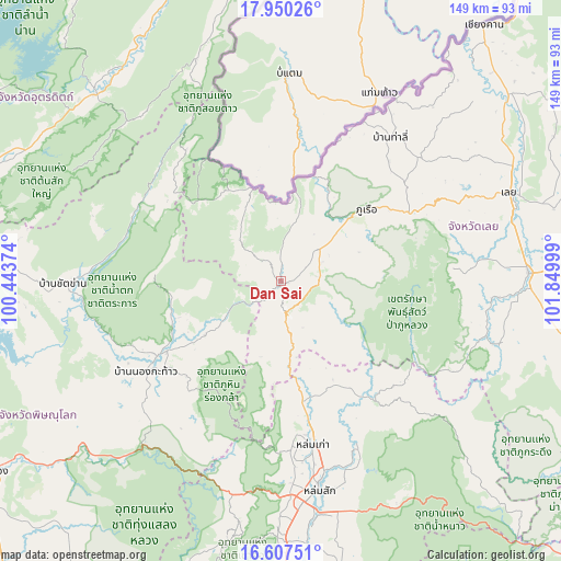
Dan Sai GPS coordinates[2]
17° 16' 48.396" North, 101° 8' 48.696" East
| Map corner | latitude | longitude |
|---|---|---|
| Upper-left | 17.95026°, | 100.44374° |
| Center: | 17.28011°, | 101.14686° |
| Lower-right: | 16.60751°, | 101.84999° |
| Map W x H: | 149.3×149.3 km | = 92.8×92.8mi |
| max Lat: | 20.43353° ⇑18.5% North |
| Dan Sai: | 17.28011° |
| min Lat: | ⇓81.5% South 5.77434° |
| min Long | Dan Sai | max Long |
| 97.93288° | 101.14686° | 105.49506° |
| W 56.7%⇐ | ⇒43.3% E |
Elevation
Elevation of Dan Sai is 357 m = 1171 ft, and this is 231.5 m = 760 ft above average elevation for this country.
| Max E: |
1011 m = 3317 ft | 6.4% |
| Dan Sai | 357 m 1171 ft | |
| Avg. | 125.5 m = 412 ft | |
Min E: |
1 m = 3 ft | 93.6% |
See also: Thailand elevation on elevation.city.
Geographical zone
Dan Sai is located in North Torrid zone (between Equator and Tropic of Cancer). Distance of this Northern Tropic circle is 684.6 km =425.4 mi to North.| Distance of | km | miles | from Dan Sai |
|---|---|---|---|
| North Pole | 8085.7 | 5024.2 | to North |
| Arctic Circle | 5479.8 | 3405 | to North |
| Tropic Cancer | 684.6 | 425.4 | to North |
| Equator | 1921.4 | 1193.9 | to South |


Nearby cities:
15 places around Dan Sai: (largest is in red/bold)
• Ban Khok
83.4 km =51.8 mi,  354°
354°
• Chat Trakan
58 km =36 mi,  269°
269°
• Khao Kho
70.4 km =43.7 mi,  190°
190°
• Loei
65.9 km =40.9 mi,  69°
69°
• Lom Kao
44.7 km =27.8 mi,  168°
168°
• Lom Sak
56.5 km =35.1 mi, 169°
• Na Haeo
24.3 km =15.1 mi,  339°
339°
• Nakhon Thai
38.5 km =23.9 mi,  238°
238°
• Nam Nao
79.6 km =49.5 mi,  135°
135°
• Nam Pat
69.9 km =43.4 mi,  315°
315°
• Nong Hin
77.5 km =48.2 mi,  102°
102°
• Phu Luang
57.1 km =35.5 mi,  105°
105°
• Phu Ruea
29.9 km =18.6 mi,  49°
49°
• Tha Li
48 km =29.8 mi,  37°
37°
• Wang Saphung
66 km =41 mi,  87°
87°
Sources, notices
• [Note1] Compared only with cities in Thailand existing in our database
• [Src1] Map data: © OpenStreetMap contributors (CC-BY-SA)
• [Src2] Other city data from geonames.org with taken over terms of usage.
• [Src3] Geographical zone / Annual Mean Temperature by Robert A. Rohde @ Wikipedia
