Serhetabat geodata
Serhetabat (Mary) is a populated place; located in Turkmenistan in Asia/Ashgabat (GMT+5) time zone. With population of 5,200 people, there are 28 cities with bigger population in this country. Compared to other cities in Turkmenistan, 100% of cities are located further ↑North; 76.7% of cities are located further ←West and 96.7% of cities have lower elevation than Serhetabat. Note1


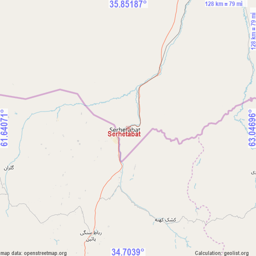
Serhetabat GPS coordinates[2]
35° 16' 47.712" North, 62° 20' 37.788" East
| Map corner | latitude | longitude |
|---|---|---|
| Upper-left | 35.85187°, | 61.64071° |
| Center: | 35.27992°, | 62.34383° |
| Lower-right: | 34.7039°, | 63.04696° |
| Map W x H: | 127.6×127.6 km | = 79.3×79.3mi |
| max Lat: | 42.32773° ⇑100% North |
| Serhetabat: | 35.27992° |
| min Lat: | ⇓0% South 35.27992° |
| min Long | Serhetabat | max Long |
| 52.95517° | 62.34383° | 66.04656° |
| W 76.7%⇐ | ⇒23.3% E |
Elevation
Elevation of Serhetabat is 643 m = 2110 ft, and this is 446.6 m = 1465 ft above average elevation for this country.
| Max E: |
649 m = 2129 ft | 3.3% |
| Serhetabat | 643 m 2110 ft | |
| Avg. | 196.4 m = 644 ft | |
Min E: |
5 m = 16 ft | 96.7% |
See also: Turkmenistan elevation on elevation.city.
Geographical zone
Serhetabat is located in North temperate zone (between Tropic of Cancer and the Arctic Circle). Distance of this Northern Tropic circle is 1316.8 km =818.2 mi to South.| Distance of | km | miles | from Serhetabat |
|---|---|---|---|
| North Pole | 6084.3 | 3780.6 | to North |
| Arctic Circle | 3478.4 | 2161.4 | to North |
| Tropic Cancer | 1316.8 | 818.2 | to South |
| Equator | 3922.8 | 2437.5 | to South |


Nearby cities:
9 places around Serhetabat: (largest is in red/bold)
• Atamyrat
382.5 km =237.7 mi,  42°
42°
• Bayramaly
260.5 km =161.9 mi,  356°
356°
• Kaka
335.7 km =208.6 mi,  313°
313°
• Mary
261.3 km =162.4 mi,  349°
349°
• Murgab
248.7 km =154.5 mi, 352°
• Saýat
412.8 km =256.5 mi,  19°
19°
• Tejen
286 km =177.7 mi,  324°
324°
• Türkmenabat
435.7 km =270.7 mi,  14°
14°
• Yolöten
224.5 km =139.5 mi,  0°
0°
Sources, notices
• [Note1] Compared only with cities in Turkmenistan existing in our database
• [Src1] Map data: © OpenStreetMap contributors (CC-BY-SA)
• [Src2] Other city data from geonames.org with taken over terms of usage.
• [Src3] Geographical zone / Annual Mean Temperature by Robert A. Rohde @ Wikipedia
