Sbikha geodata
Sbikha (Kairouan) is a populated place; located in Tunisia in Africa/Tunis (GMT+1) time zone. With population of 7,062 people, there are 100 cities with bigger population in this country. Compared to other cities in Tunisia, 54.5% of cities are located further ↓South; 60.1% of cities are located further →East and 62.2% of cities have lower elevation than Sbikha. Note1


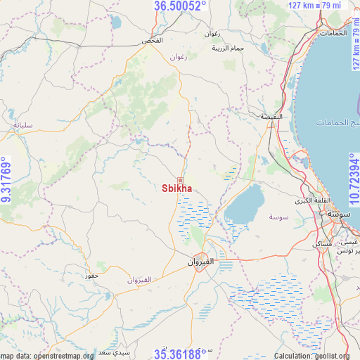
Sbikha GPS coordinates[2]
35° 55' 59.7" North, 10° 1' 14.916" East
| Map corner | latitude | longitude |
|---|---|---|
| Upper-left | 36.50052°, | 9.31769° |
| Center: | 35.93325°, | 10.02081° |
| Lower-right: | 35.36188°, | 10.72394° |
| Map W x H: | 126.6×126.6 km | = 78.7×78.7mi |
| max Lat: | 37.27442° ⇑45.5% North |
| Sbikha: | 35.93325° |
| min Lat: | ⇓54.5% South 32.31662° |
| min Long | Sbikha | max Long |
| 7.87765° | 10.02081° | 11.21965° |
| W 39.9%⇐ | ⇒60.1% E |
Elevation
Elevation of Sbikha is 66 m = 217 ft, and this is 83.4 m = 274 ft below average elevation for this country.
| Max E: |
999 m = 3278 ft | 37.8% |
| Avg. | 149.4 m = 490 ft | |
| Sbikha | 66 m = 217 ft | |
Min E: |
-6 m = -20 ft | 62.2% |
See also: Tunisia elevation on elevation.city.
Geographical zone
Sbikha is located in North temperate zone (between Tropic of Cancer and the Arctic Circle). Distance of this Northern Tropic circle is 1389.5 km =863.4 mi to South.| Distance of | km | miles | from Sbikha |
|---|---|---|---|
| North Pole | 6011.7 | 3735.5 | to North |
| Arctic Circle | 3405.8 | 2116.3 | to North |
| Tropic Cancer | 1389.5 | 863.4 | to South |
| Equator | 3995.4 | 2482.6 | to South |


Nearby cities:
15 places around Sbikha: (largest is in red/bold)
• Akouda
49.6 km =30.8 mi,  98°
98°
• Bou Arada
58.8 km =36.5 mi,  322°
322°
• El Fahs
50.1 km =31.1 mi,  348°
348°
• Haffouz
45.7 km =28.4 mi,  222°
222°
• Hammam Sousse
53.1 km =33 mi, 98°
• Harqalah
45.2 km =28.1 mi,  76°
76°
• Kairouan
29.2 km =18.1 mi,  166°
166°
• Kesra
60.6 km =37.7 mi,  257°
257°
• Msaken
55.3 km =34.4 mi,  114°
114°
• Port el Kantaoui
51.8 km =32.2 mi, 95°
• Sidi Bou Ali
40.8 km =25.4 mi,  86°
86°
• Sidi el Hani
39.4 km =24.5 mi,  137°
137°
• Siliana
60.8 km =37.8 mi,  286°
286°
• Sousse
56.8 km =35.3 mi, 102°
• Zaghouan
53.4 km =33.2 mi,  11°
11°
Sources, notices
• [Note1] Compared only with cities in Tunisia existing in our database
• [Src1] Map data: © OpenStreetMap contributors (CC-BY-SA)
• [Src2] Other city data from geonames.org with taken over terms of usage.
• [Src3] Geographical zone / Annual Mean Temperature by Robert A. Rohde @ Wikipedia
