Yakutiye geodata
Yakutiye (Erzurum) is a seat of a second-order administrative division; located in Turkey in Europe/Istanbul (GMT+3) time zone. In our database, there are 1323 cities with bigger population. Compared to other cities in Turkey, 67.3% of cities are located further ↓South; 83.7% of cities are located further ←West and 98.7% of cities have lower elevation than Yakutiye. Note1


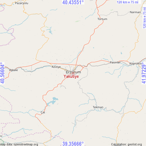
Yakutiye GPS coordinates[2]
39° 53' 53.556" North, 41° 16' 8.976" East
| Map corner | latitude | longitude |
|---|---|---|
| Upper-left | 40.43551°, | 40.56604° |
| Center: | 39.89821°, | 41.26916° |
| Lower-right: | 39.35666°, | 41.97229° |
| Map W x H: | 120×120 km | = 74.6×74.6mi |
| max Lat: | 42.02683° ⇑32.7% North |
| Yakutiye: | 39.89821° |
| min Lat: | ⇓67.3% South 35.9025° |
| min Long | Yakutiye | max Long |
| 25.90902° | 41.26916° | 44.60099° |
| W 83.7%⇐ | ⇒16.3% E |
Elevation
Elevation of Yakutiye is 1938 m = 6358 ft, and this is 1220.6 m = 4005 ft above average elevation for this country.
| Max E: |
2682 m = 8799 ft | 1.3% |
| Yakutiye | 1938 m 6358 ft | |
| Avg. | 717.4 m = 2354 ft | |
Min E: |
0 m = 0 ft | 98.7% |
See also: Turkey elevation on elevation.city.
Geographical zone
Yakutiye is located in North temperate zone (between Tropic of Cancer and the Arctic Circle). Distance of this Northern Tropic circle is 1830.3 km =1137.3 mi to South.| Distance of | km | miles | from Yakutiye |
|---|---|---|---|
| North Pole | 5570.8 | 3461.5 | to North |
| Arctic Circle | 2964.9 | 1842.3 | to North |
| Tropic Cancer | 1830.3 | 1137.3 | to South |
| Equator | 4436.3 | 2756.6 | to South |


Nearby cities:
15 places around Yakutiye: (largest is in red/bold)
• Aşkale
49 km =30.4 mi,  272°
272°
• Dadaşköy
5.3 km =3.3 mi,  346°
346°
• Dumlu
19.3 km =12 mi,  22°
22°
• Erzurum
1.3 km =0.8 mi,  29°
29°
• Gökoğlan
39.2 km =24.4 mi,  175°
175°
• Ilıca
15.8 km =9.8 mi,  289°
289°
• Kandilli
36.9 km =22.9 mi, 271°
• Kazımkarabekir
2.2 km =1.4 mi, 27°
• Ovacık
40.8 km =25.4 mi,  325°
325°
• Palandöken
1.4 km =0.9 mi,  136°
136°
• Pasinler
35.4 km =22 mi,  75°
75°
• Söylemez
48 km =29.8 mi,  108°
108°
• Tekman
35 km =21.7 mi, 144°
• Tortum
49.2 km =30.6 mi, 28°
• Çat
41.4 km =25.7 mi,  218°
218°
Sources, notices
• [Note1] Compared only with cities in Turkey existing in our database
• [Src1] Map data: © OpenStreetMap contributors (CC-BY-SA)
• [Src2] Other city data from geonames.org with taken over terms of usage.
• [Src3] Geographical zone / Annual Mean Temperature by Robert A. Rohde @ Wikipedia
