Ilıca geodata
Ilıca (Erzurum) is a seat of a third-order administrative division; located in Turkey in Europe/Istanbul (GMT+3) time zone. With population of 12,922 people, there are 428 cities with bigger population in this country. Compared to other cities in Turkey, 68.3% of cities are located further ↓South; 82.2% of cities are located further ←West and 96.6% of cities have lower elevation than Ilıca. Note1


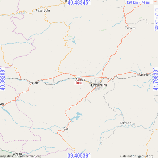
Ilıca GPS coordinates[2]
39° 56' 47.508" North, 41° 5' 42.72" East
| Map corner | latitude | longitude |
|---|---|---|
| Upper-left | 40.48345°, | 40.39208° |
| Center: | 39.94653°, | 41.0952° |
| Lower-right: | 39.40536°, | 41.79833° |
| Map W x H: | 119.9×119.9 km | = 74.5×74.5mi |
| max Lat: | 42.02683° ⇑31.7% North |
| Ilıca: | 39.94653° |
| min Lat: | ⇓68.3% South 35.9025° |
| min Long | Ilıca | max Long |
| 25.90902° | 41.0952° | 44.60099° |
| W 82.2%⇐ | ⇒17.8% E |
Elevation
Elevation of Ilıca is 1768 m = 5801 ft, and this is 1050.6 m = 3447 ft above average elevation for this country.
| Max E: |
2682 m = 8799 ft | 3.4% |
| Ilıca | 1768 m 5801 ft | |
| Avg. | 717.4 m = 2354 ft | |
Min E: |
0 m = 0 ft | 96.6% |
See also: Turkey elevation on elevation.city.
Geographical zone
Ilıca is located in North temperate zone (between Tropic of Cancer and the Arctic Circle). Distance of this Northern Tropic circle is 1835.7 km =1140.7 mi to South.| Distance of | km | miles | from Ilıca |
|---|---|---|---|
| North Pole | 5565.4 | 3458.2 | to North |
| Arctic Circle | 2959.5 | 1838.9 | to North |
| Tropic Cancer | 1835.7 | 1140.7 | to South |
| Equator | 4441.6 | 2759.9 | to South |


Nearby cities:
15 places around Ilıca: (largest is in red/bold)
• Aşkale
34.2 km =21.3 mi,  265°
265°
• Dadaşköy
13.6 km =8.5 mi,  90°
90°
• Dumlu
25.5 km =15.8 mi,  60°
60°
• Erzurum
16.1 km =10 mi,  105°
105°
• Gökoğlan
47.9 km =29.8 mi,  158°
158°
• Kandilli
22.5 km =14 mi,  258°
258°
• Kazımkarabekir
16.2 km =10.1 mi,  102°
102°
• Kırık
45 km =28 mi,  340°
340°
• Ovacık
29.4 km =18.3 mi, 343°
• Palandöken
17.1 km =10.6 mi, 112°
• Pasinler
49.1 km =30.5 mi, 85°
• Tekman
48.8 km =30.3 mi,  134°
134°
• Yakutiye
15.8 km =9.8 mi, 109°
• Çat
39.3 km =24.4 mi,  195°
195°
• Çiftlik
43.3 km =26.9 mi,  245°
245°
Sources, notices
• [Note1] Compared only with cities in Turkey existing in our database
• [Src1] Map data: © OpenStreetMap contributors (CC-BY-SA)
• [Src2] Other city data from geonames.org with taken over terms of usage.
• [Src3] Geographical zone / Annual Mean Temperature by Robert A. Rohde @ Wikipedia
