Yahyalı geodata
Yahyalı (Kayseri) is a seat of a second-order administrative division; located in Turkey in Europe/Istanbul (GMT+3) time zone. With population of 25,019 people, there are 286 cities with bigger population in this country. Compared to other cities in Turkey, 59.8% of cities are located further ↑North; 52.8% of cities are located further →East and 79.2% of cities have lower elevation than Yahyalı. Note1


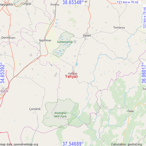
Yahyalı GPS coordinates[2]
38° 6' 8.208" North, 35° 21' 25.344" East
| Map corner | latitude | longitude |
|---|---|---|
| Upper-left | 38.65348°, | 34.65392° |
| Center: | 38.10228°, | 35.35704° |
| Lower-right: | 37.54689°, | 36.06017° |
| Map W x H: | 123×123 km | = 76.4×76.4mi |
| max Lat: | 42.02683° ⇑59.8% North |
| Yahyalı: | 38.10228° |
| min Lat: | ⇓40.2% South 35.9025° |
| min Long | Yahyalı | max Long |
| 25.90902° | 35.35704° | 44.60099° |
| W 47.2%⇐ | ⇒52.8% E |
Elevation
Elevation of Yahyalı is 1180 m = 3871 ft, and this is 462.6 m = 1518 ft above average elevation for this country.
| Max E: |
2682 m = 8799 ft | 20.8% |
| Yahyalı | 1180 m 3871 ft | |
| Avg. | 717.4 m = 2354 ft | |
Min E: |
0 m = 0 ft | 79.2% |
See also: Turkey elevation on elevation.city.
Geographical zone
Yahyalı is located in North temperate zone (between Tropic of Cancer and the Arctic Circle). Distance of this Northern Tropic circle is 1630.7 km =1013.3 mi to South.| Distance of | km | miles | from Yahyalı |
|---|---|---|---|
| North Pole | 5770.5 | 3585.6 | to North |
| Arctic Circle | 3164.6 | 1966.4 | to North |
| Tropic Cancer | 1630.7 | 1013.3 | to South |
| Equator | 4236.6 | 2632.5 | to South |


Nearby cities:
15 places around Yahyalı: (largest is in red/bold)
• Aladağ
61.7 km =38.3 mi,  176°
176°
• Bakırdağı
39.9 km =24.8 mi,  71°
71°
• Derinkuyu
62.3 km =38.7 mi,  299°
299°
• Develi
34.2 km =21.3 mi,  20°
20°
• Feke
58.3 km =36.2 mi,  123°
123°
• Hacılar
61 km =37.9 mi,  7°
7°
• Mansurlu
38.4 km =23.9 mi,  137°
137°
• Misli
52.7 km =32.7 mi,  285°
285°
• Niğde
61.3 km =38.1 mi,  255°
255°
• Saimbeyli
65.5 km =40.7 mi,  101°
101°
• Toklar
67.3 km =41.8 mi,  58°
58°
• Tomarza
54.4 km =33.8 mi,  45°
45°
• Yeşilhisar
36.4 km =22.6 mi,  319°
319°
• Çamardı
44.6 km =27.7 mi,  227°
227°
• İncesu
59.8 km =37.2 mi,  345°
345°
Sources, notices
• [Note1] Compared only with cities in Turkey existing in our database
• [Src1] Map data: © OpenStreetMap contributors (CC-BY-SA)
• [Src2] Other city data from geonames.org with taken over terms of usage.
• [Src3] Geographical zone / Annual Mean Temperature by Robert A. Rohde @ Wikipedia
